SACRAMENTO, Calif. — Northern California’s latest fire-prevention power shutoffs are ending, but forecasters warn there will be another round of gusty offshore winds starting late in the weekend.
About three-quarters of the 31,000 Pacific Gas & Electric customers who were blacked out Wednesday night had power restored by Thursday evening and the roughly 8,000 remaining are expected to be powered up by the end of Friday.
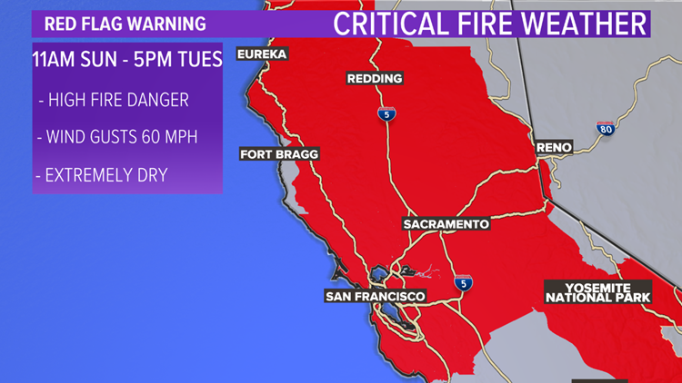
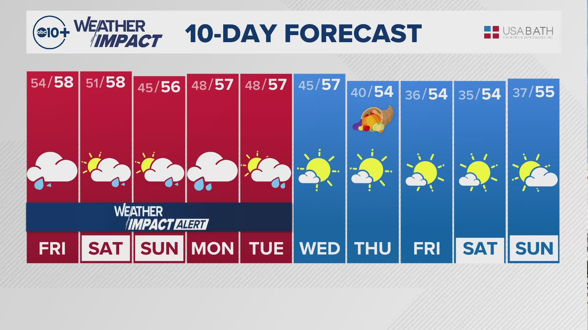
On, Friday the weather will start off sunny and dry with lingering winds and a Red Flag Warning for portions of Northern California under a fire risk. By Friday night, the winds relax and perfect fall weather sets in.
Saturday will be a classic fall day, with crisp temperatures in the 40s for the morning and highs in the low 70s. Air quality should be great and winds will be light. When people think of a perfect fall day that is cozy and nice, Saturday will have that kind of weather region-wide.
PG&E advises that a potentially larger public safety power shutoff could begin Sunday, Oct. 25. The areas that could be impacted include "the northern and western Sacramento Valley, Northern and Central Sierra, higher terrain of the Bay Area, the Santa Cruz Mountains, Central Coast Region and portions of southern Kern."
More than 171,000 customers are estimated to be affected by the potential outages in the ABC10 viewing area. Here is how many customers in some counties could potentially be impacted by PG&E's latest round of power shutoffs:
- Amador: 10,448
- Calaveras: 19,329
- Colusa: 565
- El Dorado: 41,009
- Nevada: 40,252
- Placer: 18,060
- San Joaquin: 10
- Sierra: 1,101
- Solano: 1,606
- Stanislaus: 35
- Tuolumne: 33,271
- Yolo: 5,361
- TOTAL: 171,047
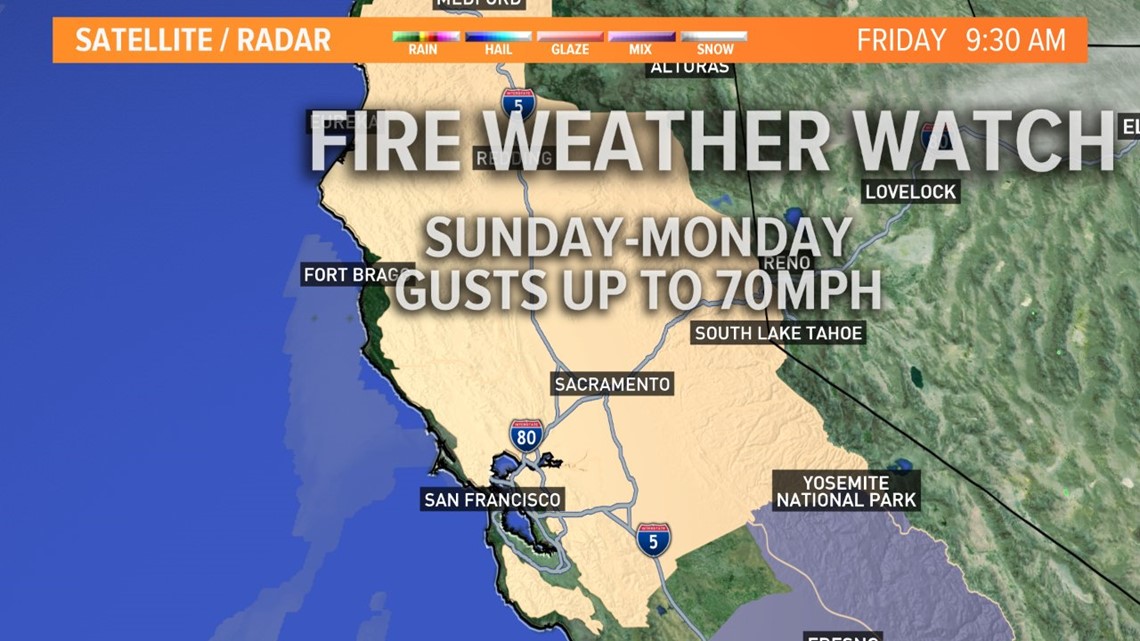
Sunday will mostly be the same with 40s in the morning and a sunny day. However Sunday night things change rapidly. By 5 p.m. Sunday, winds will begin picking up and after sunset, windy weather will start to dominate the area.


In the middle of the night between Sunday and Monday, wind will max out across the region and the wind prone spots like canyons, passes, and ridges could see gusts up to 70 mph. The National Weather Service says wind gusts could reach 40 - 50 mph. Dry conditions are expected to continue through Tuesday, Oct. 27.
In the less windy areas, we could still see gusts up to 30-50mph and that may cause damage, fences, and trees could topple over and we could see some power outages.
This wind event is in the same league as the 2019 Sonoma County fire outbreak, as well as the 2017 wine country fires. Some fire danger may have been reduced by large burns in recent years, but the risk is high and officials are calling the fire risk "extreme"
Wildfire Preparedness
If you live in a wildfire-prone zone, Cal Fire suggests creating a defensible space around your home. Defensible space is an area around a building in which vegetation and other debris are completely cleared. At least 100 feet is recommended.
The Department of Homeland Security suggests assembling an emergency kit that has important documents, N95 respirator masks, supplies to grab with you if you’re forced to leave at a moment’s notice. The agency also suggests signing up for local warning system notifications and know your community’s evacuation plans to best prepare yourself and your family in cases of wildfires.
►Stay in the know! Sign up now for the Daily Blend Newsletter
Watch more:


