This winter has already been one for the record books. Thanks to a constant string of atmospheric rivers, fueled by a weak El Nino, this season the Sierra snowpack is 153% of average.
It's the 6th wettest February ever recorded. And, as of October 1, 2018, Sacramento has picked up more than 18 inches of rainfall, which is roughly 4 inches above average for this time of the year.
So, with all of this rainfall, you might be thinking our wildfire season may not be as active this upcoming summer and fall. Well, that's not necessarily the case.
Steve Leach is a Meteorologist for the Bureau of Land Management. His job is to help to assess how the current weather along with future weather patterns could or may impact the upcoming wildfire season.
RELATED: 11 percent of California is still in drought, but history shows that could always change | GEEK LAB
One of the most telling indicators is the potential growth of natural grasses, weeds, and flowers. Leach says precipitation, plus warmth, plus sun, are the perfect ingredients for a tall crop of grass. And with this season's heavy rainfall, we're expecting a super bloom for flowers along with fire fuels in the form of light brown cover all over the valley and hills.


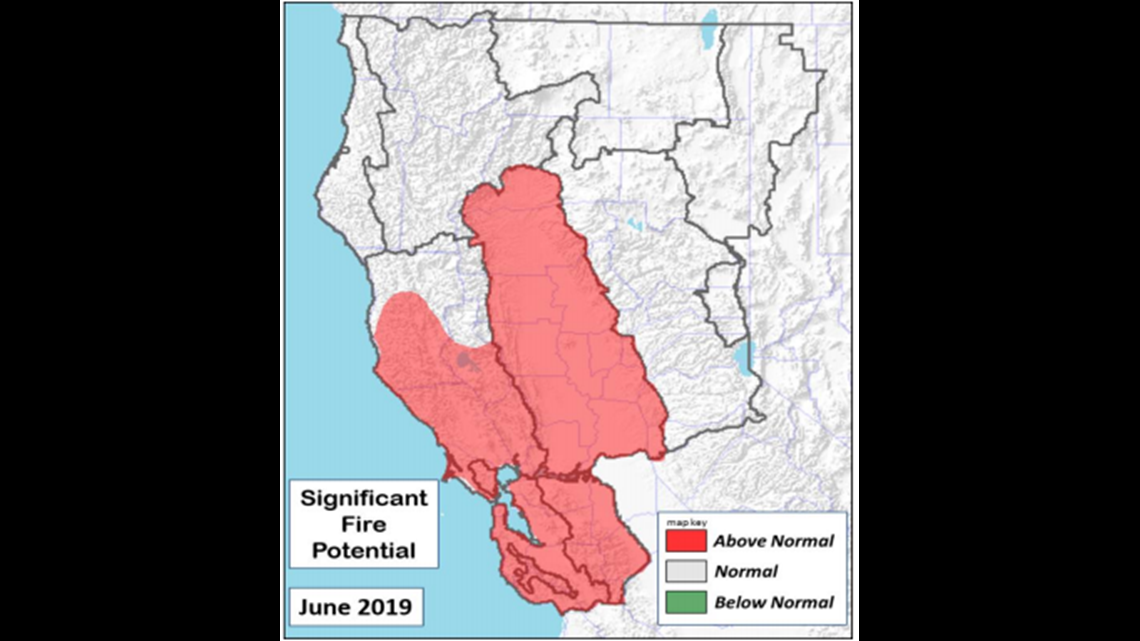
Unfortunately, that could lead to an increased opportunity for fire development in June for lower elevations (below 3,500 ft).
"As conditions turn warmer and drier than normal late in the spring, lower elevations will likely see fine fuels cure out and brush dry enough to carry fire in June," said Leach.
The takeaway, according to Leach, "areas dominated by fine fuels located in the Sacramento Valley and Foothills, Bay Area and all but the Mendocino portion of the Mid Coast have above normal Significant Fire Potential."
That's because lower elevations tend to dry out first then followed my middle elevations (3,500 - 6,500 ft). They are expected to dry out in July. Higher elevations (above 6,500 ft) are expected to dry out last, which will lead to a delayed start in those areas.
The bottom line, no matter how much rainfall we pick up this season, with the notoriously hot and dry conditions of our summer months, by July and August, all bets are off, according to Leach.


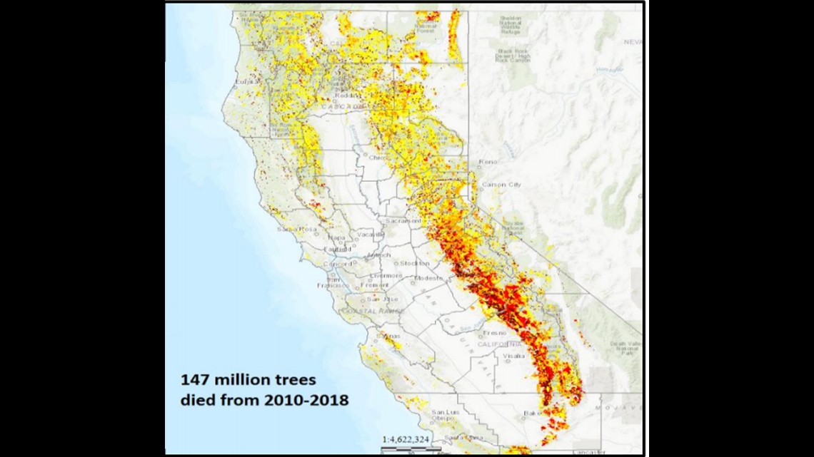
Another indicator used to assess our upcoming wildfire season is the tree mortality rate. The tree mortality density in portions of the state is pretty bad. After picking up a rare snowfall in February, many trees near the Redding area were left badly damaged. Leach says it's the most tree damage he's ever seen. Fortunately, there will be more of an effort to clean these areas with more tree burning.
Leach's next report is due out April 1, 2019. This report will assess which parts of Northern California, including the Sacramento Valley, have significant fire potential for July 2019.
Continue the conversation with Tracy on Facebook.
________________________________________________________________
Heavy rainfall turned into flash floods, taking lots of Tuolumne County residents completely by surprise. According to the Sonora police chief, a flash flooding event like this hasn't happened since the 90s.

