SACRAMENTO, Calif. — The most impactful winter storm of the season thus far is on the way. Climate outlooks were predicting a wet November, and it seems a wet November is exactly what we are getting here in California.
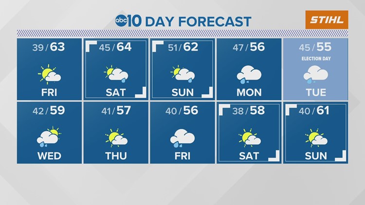
After a short break from wet weather, moisture will return Saturday. The first wave of storms will likely bring light rain to the region, including most of the Sierra, with snow levels expected to start around 8,500 feet before colder air works its way into the area.
Rain in Sacramento is expected to be less than a tenth of an inch and will fall in the afternoon hours. Rain chances currently sit around 50% for Sacramento, with the highest chances east of I-5. Rain is more likely to fall in the foothills and Sierra where 0.25 - 1" is possible. Only a few inches of snow are expected in the higher elevations due to the associated warmer temperatures.
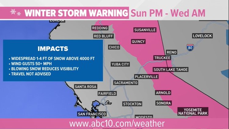
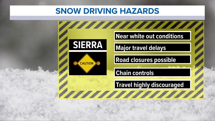
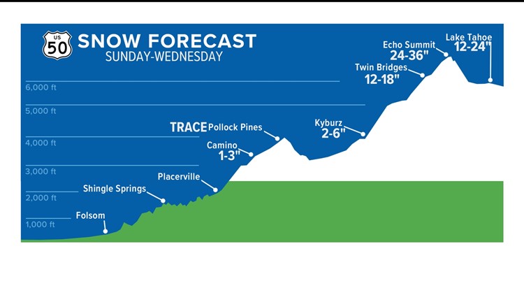
The brunt of the storm is expected from Sunday night through Wednesday. The National Weather Service issued a Winter Storm Warning ahead of the system. Travel is highly discouraged through the Sierra during this event due to dangerous conditions.


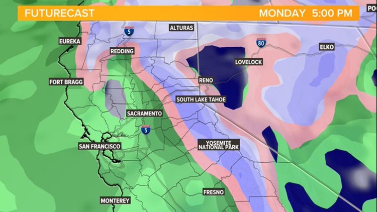
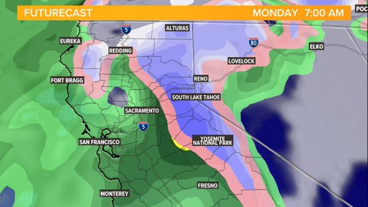
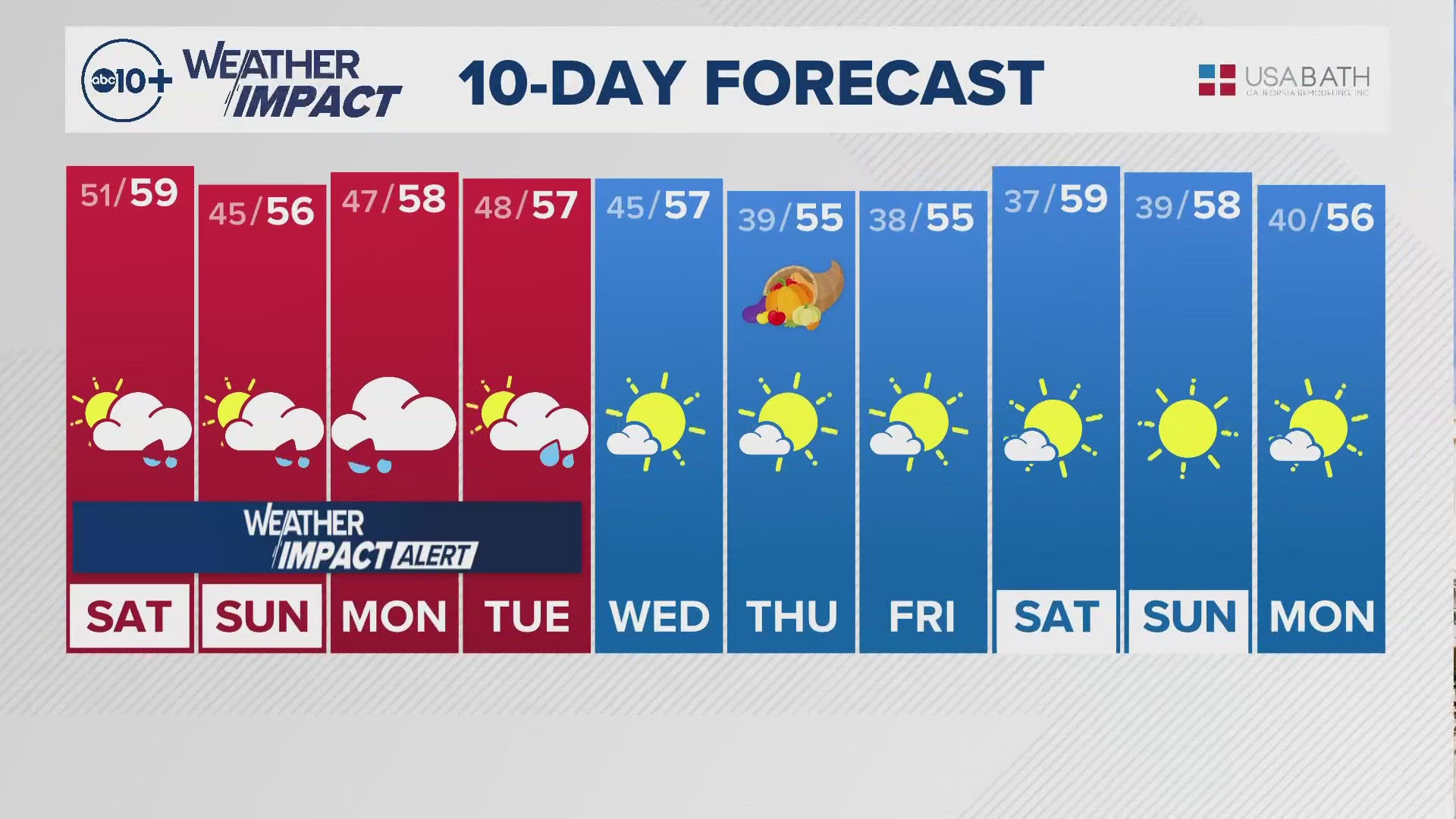
The first band of rain will come through the region late Sunday night into early Monday morning. Temperatures will be noticeably cooler compared to the weekend, with temperatures in the mid 50s expected on Monday in the valley and 30s in the Sierra.


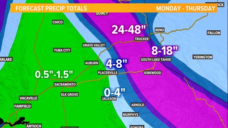
Rain will continue throughout the day along with mountain snow. Precipitation totals are expected to range from 0.5-1" on Monday throughout the valley.


Rain will likely continue into Election Day but is expected to stop in the evening hours, leaving a bit of time of dry weather to vote before polls close. Election Day temperatures are expected to sit in the low 50s, which is much below-average for this time of year. Some valley locations may not even reach a high of 50 degrees as the coldest air associated with the storm moves in. Snow levels will drop down to about 3,500 feet Tuesday.

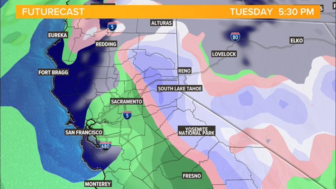
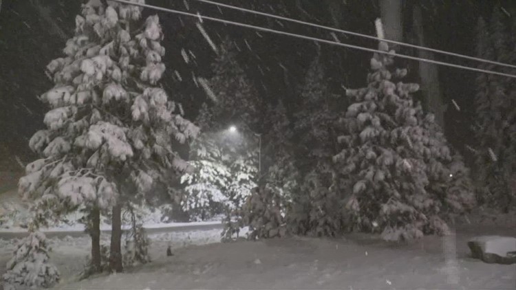
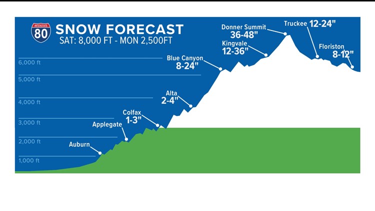
Snow showers will continue in the Sierra into Wednesday with a few valley showers possible as well. Through Wednesday, Sacramento could see up to 1.5" of rain while Stockton and Modesto could see up to an inch. Foothill areas below the snow line could see 2-3" of rain as well, and areas over 4,000 feet will likely see 2-4 feet of snow.


Models are hinting at this pattern of below-average temperatures and above-average rainfall sticking around until at least mid-November, which is fantastic news for a state desperate for a wet winter.


