CALIFORNIA, USA — Monday 6:30 p.m. Update:
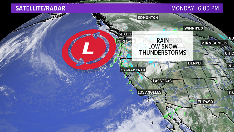
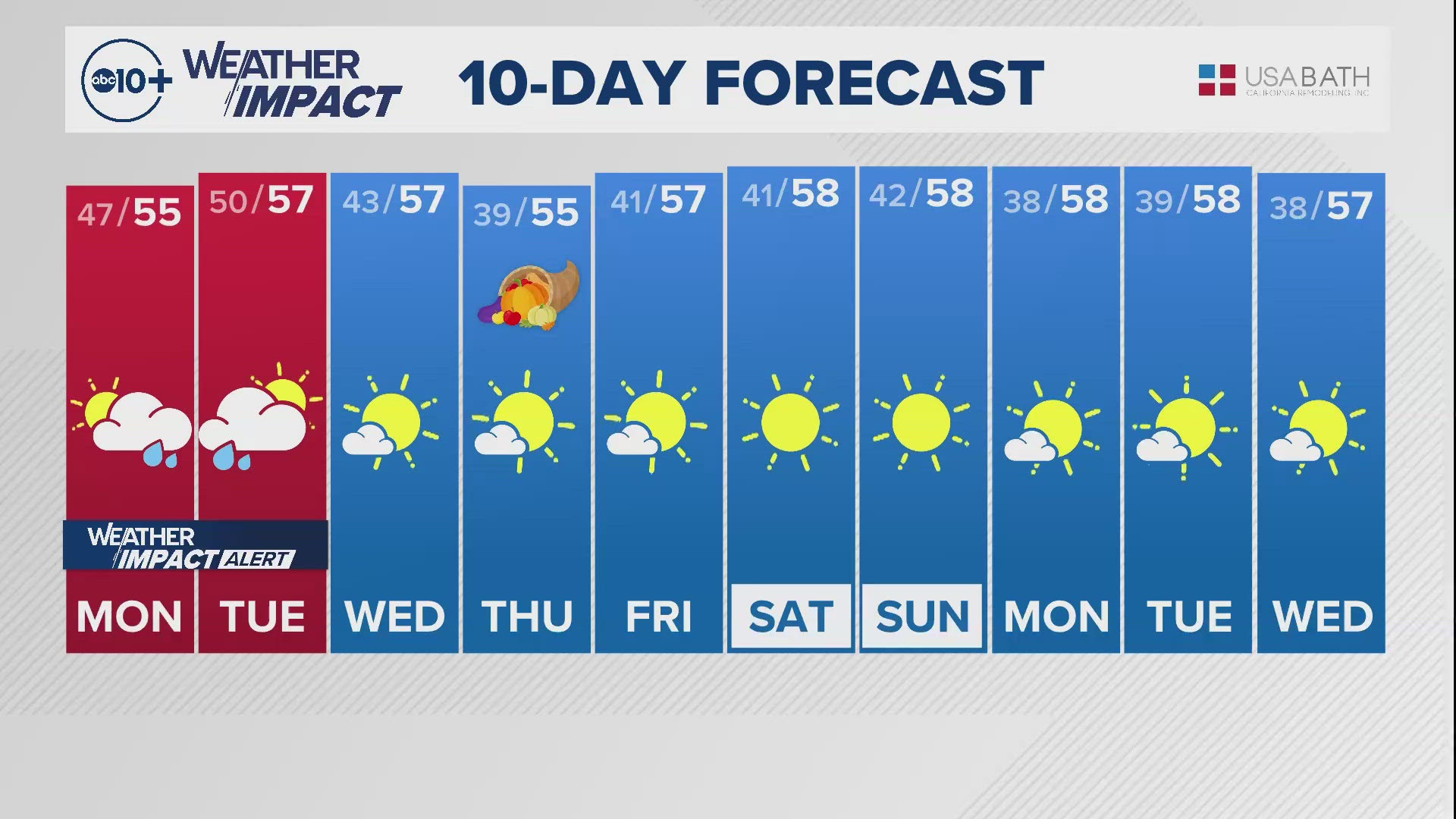
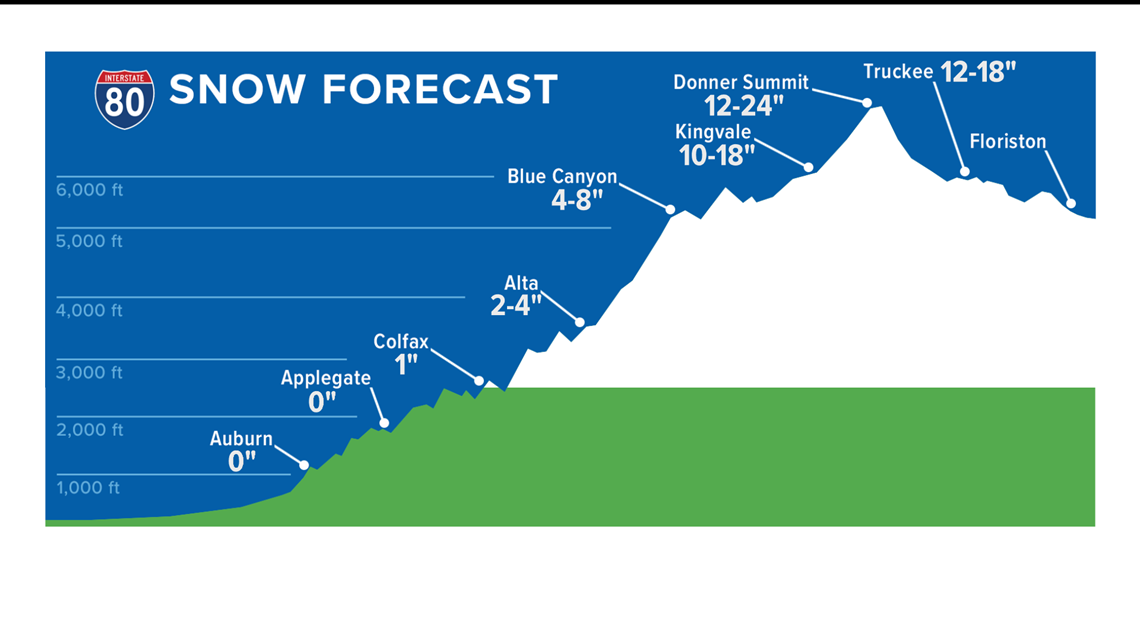
Winter weather returns to Northern California through the first part of the workweek. Light showers fell Monday north of I-80 but snow caused traffic problems in the Sierra. I-80 Westbound was held at the Donner Lake Interchange due to multiple spinouts. Chains were also required during the evening.
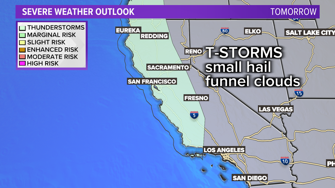
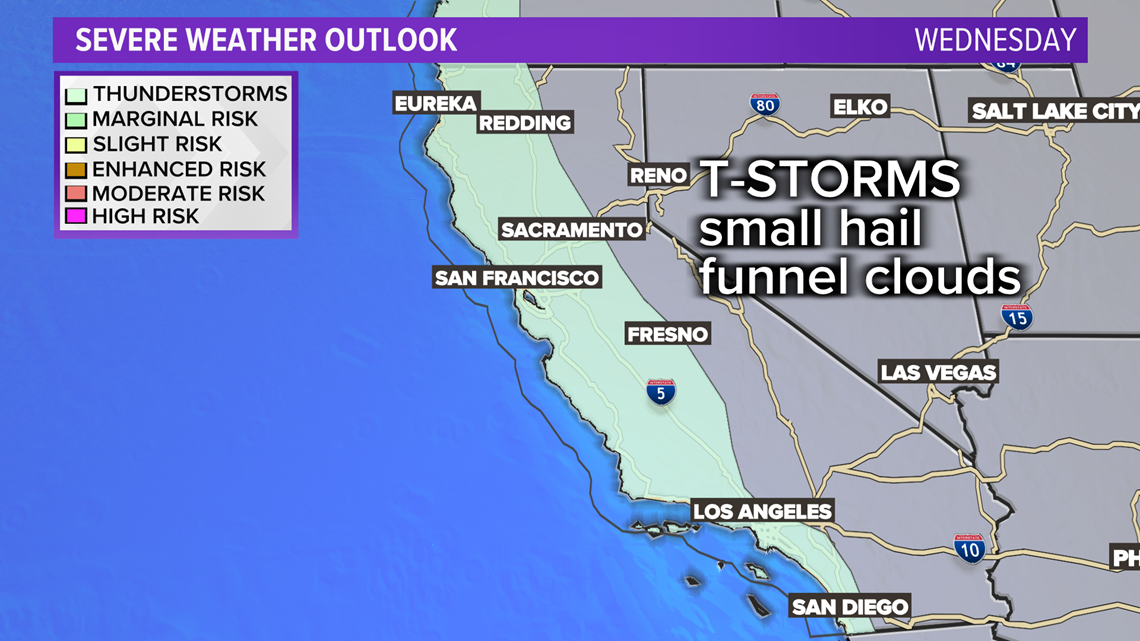
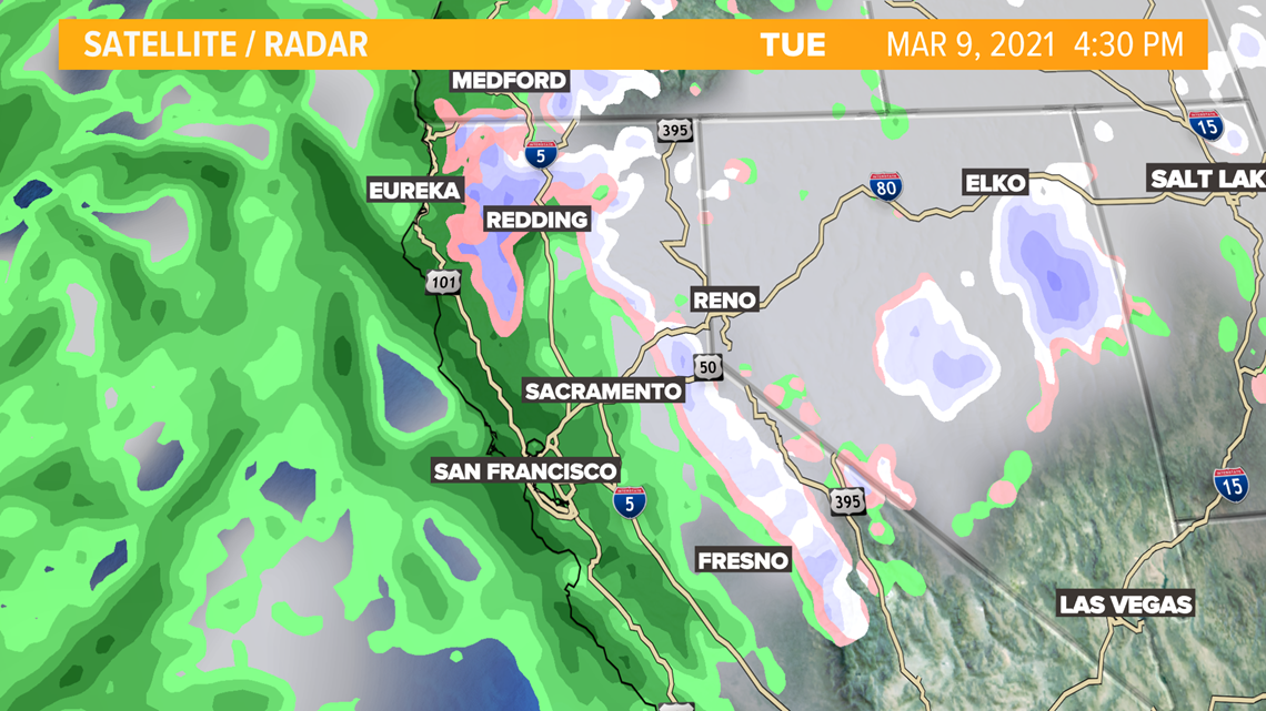
The valley didn't pick up much rain but more widespread showers and possible thunderstorms are expected Tuesday and Wednesday. These storms could produce small hail, funnel clouds and even some small tornadoes.
Below are the areas at greatest risk of stormy weather.


UPDATE: Sunday 6 p.m.
Limited showers expected south of Sacramento County. Light showers Monday with widespread rain, low snow and possible thunderstorms developing Tuesday and possibly Wednesday.
Some thunderstorms will produce small hail and possible funnel clouds.
ORGINAL:
The weekend sunshine comes to an end for the start of the work week. Monday is expected to be sunny for half the day before clouds roll into the afternoon, and the evening commute might be met with some scattered showers.

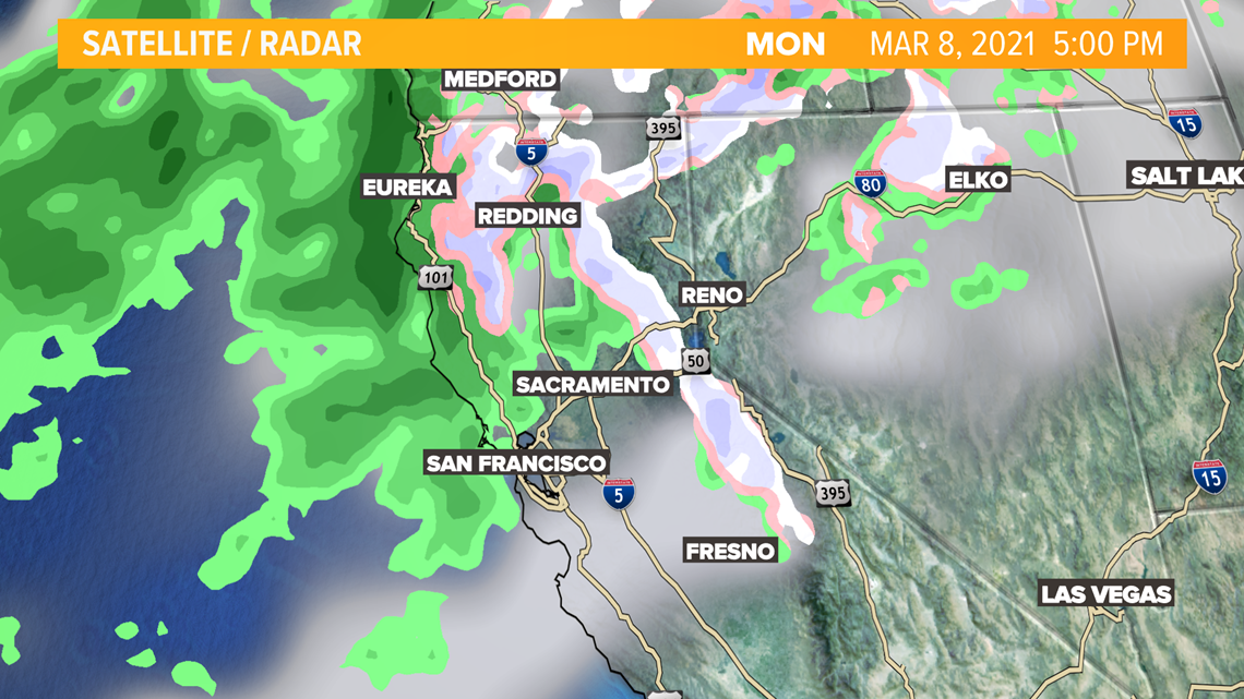
By Tuesday, showers and thunderstorm chances are possible. A mix of rain, sun, and winds will create instability over Northern California. This unstable weather may create the chance for thunderstorms Tuesday and Tuesday night. Hail is also a possibility for the Sierra foothills, Motherlode, and Valley. More thunderstorm chances are possible Wednesday.

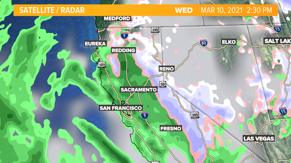
On Wednesday, more showers will move through, heading south into Central and Southern California by Wednesday afternoon.

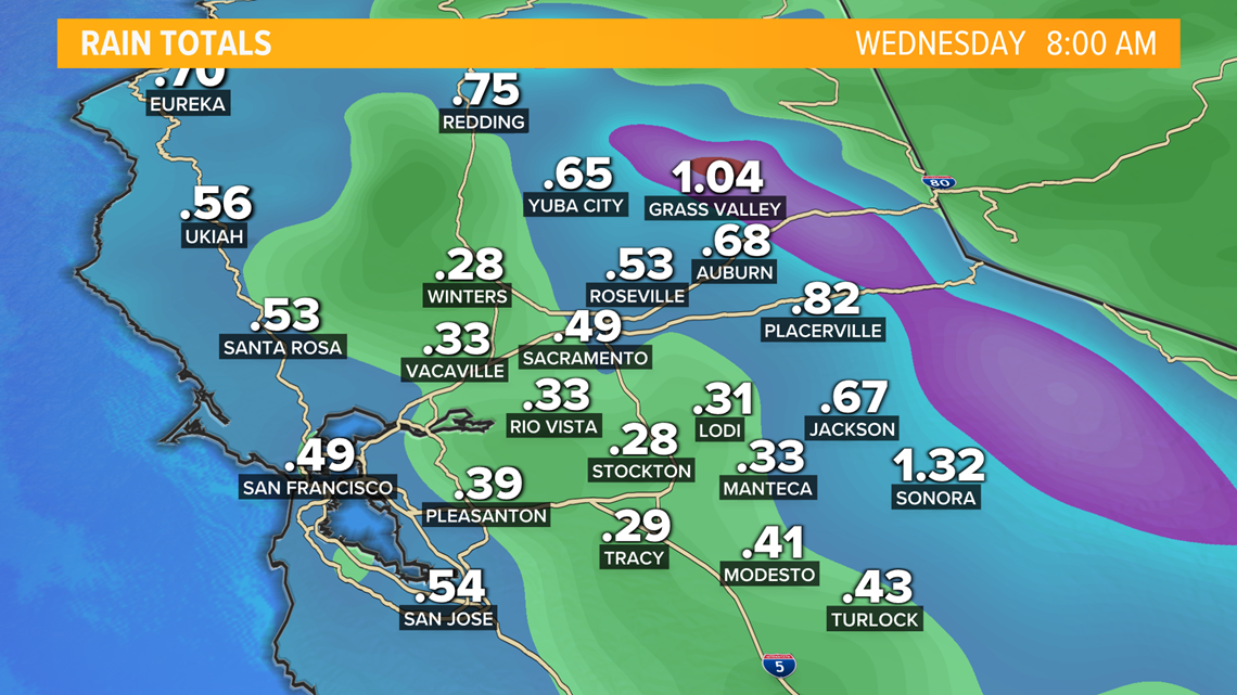
Rain totals over the next 3 days are expected to be anywhere from .10 to .33 of an inch for the Valley. Totals in the foothills could be a half inch to an inch of rain.

Snow levels may drop as low as 2,500 to 3,000 feet Tuesday morning and Wednesday morning. 1 to 2 feet of snow might be expected at the summits and highest elevations around 7,000 feet. As little as an inch may accumulate around 2,000 to 2,500 feet in elevation.

WATCH ALSO:


