SACRAMENTO, Calif —
A cool, mostly dry weekend is on tap for Northern California.
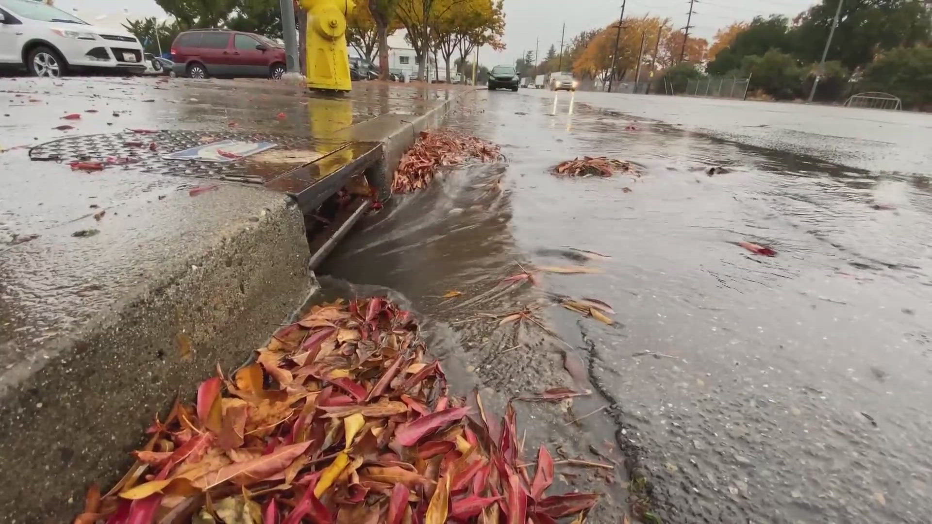
A final shot of moisture thanks to a relatively weak low pressure system Wednesday capped off an extremely eventful last 10 days of weather.
Valley rain totals generally ranged from 0.25-0.75” and Sacramento received 0.5” at Executive Airport. The Sierra received 3-9" of fresh snow.
The statewide snowpack is now at 75% of average to date thanks to the 3-6 feet of snow that fell in the past 10 days.
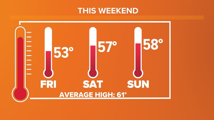
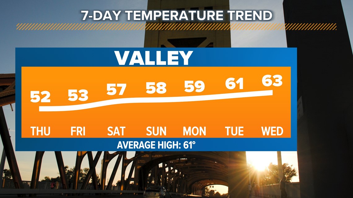
Although no rain and minimal snow is expected this weekend, temperatures will remain cool but each day will see small increases in the high temperature. On Thursday, the valley will see highs in the low 50s to around 50, by Friday low to mid 50s are expected, and mid to upper 50s Saturday and Sunday. The average high temperature for this time of year is 61 degrees in Sacramento.

Sierra high temperatures will be in the upper 20s and 30s through the weekend.
Low temperatures will be chilly with 30s in the valley and Sierra lows will dip into the teens.
Winds will be light throughout the weekend and mostly sunny skies are expected by Saturday.
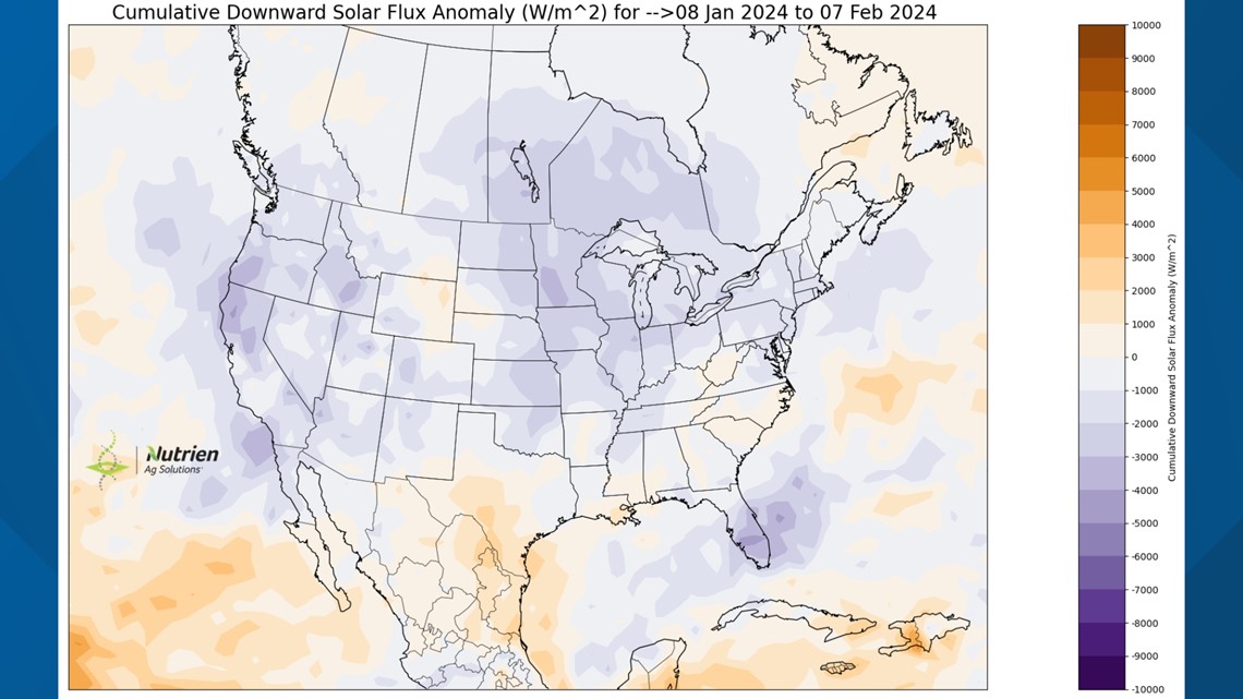
Even with it being the cloudiest time of year in Northern California, the last 30 days have still been exceptionally cloudy.
Cumulative downward solar flux, a measure of how much solar radiation makes it to the ground vs. how much is reflected by cloud cover, is presented on the map below. Purple correlates to cloudier than normal conditions and it's easy to see how uncommonly cloudy it has been in the past 30 days for most of the country, including California.

A few snow showers are possible across the Sierra Saturday thanks to an inside slider system lightly brushing the state. This will be a low impact event but expect to see periods of light snow if you happen to be in the Sierra Thursday night or Friday.
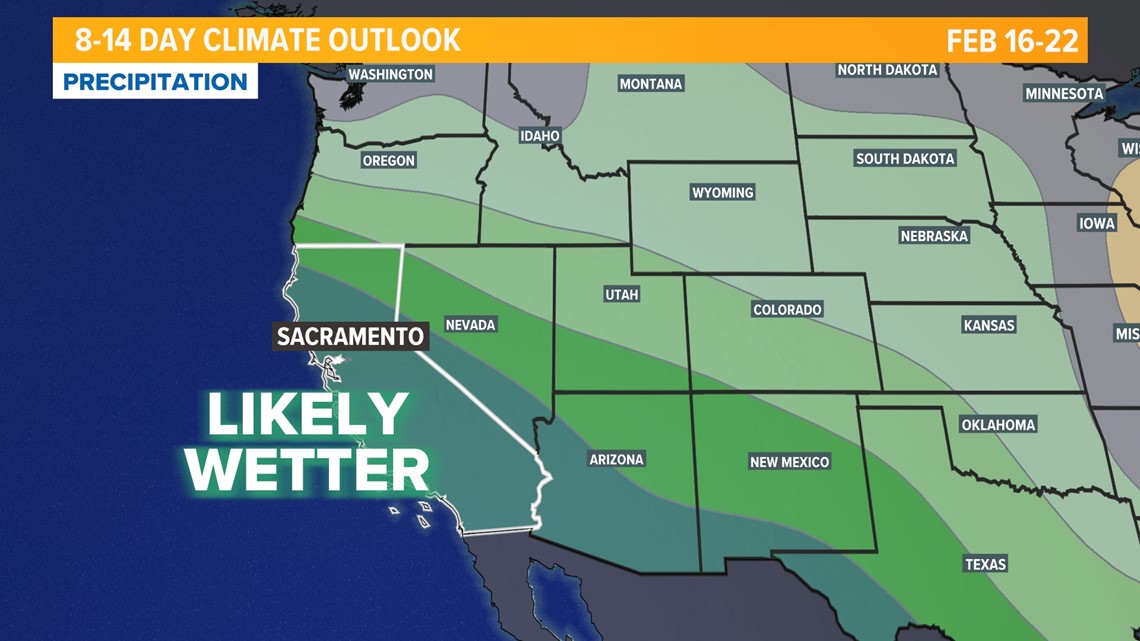
The dry stretch isn’t expected to last too long, though. The Climate Prediction Center favors a continuation of an El Niño like pattern to redevelop by next weekend, meaning wetter and warmer conditions in Northern California thanks to a robust subtropical jet stream.