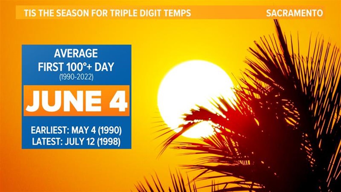
SACRAMENTO, Calif — Usually, Sacramento would have reached 100 degrees at least once by now. But not this year.
The first time Sacramento usually sees a 100 degree day is on June 4 (for the 1990-2022 timeframe), but as of publication, it's the middle of June with no 100 degree days yet.
Although high pressure is currently building in, it won’t be strong enough to push temperatures to the century mark in the Sacramento area. For other valley areas, like Redding and Chico, this is not the case and temperatures by Friday will be flirting with 100 degree temperatures.
Sacramento generally stays cooler than these places due to the breezes that are ushered into the region from the ocean and through the Delta. The influence of the Delta breeze doesn’t make it all the way up there, keeping temperatures elevated. Still, it remains an anomaly that Sacramento has yet to see 100 degree temperatures this late in the year.
In 2022, the month of June had 11 days that met or exceeded 100 degrees. In fact, downtown Sacramento has reached 100 degrees at least once every June since 1998. There's still a lot of June left, but it is fairly remarkable that the city has avoided triple digits so far, especially considering there are no signs of reaching 100 anytime soon.

Why has it been so cool?
Low pressure regimes have dominated California this year, dating back to the record wet winter. This pattern has dragged into spring, and every month in 2023 has been below average in terms of temperature except for January and April.
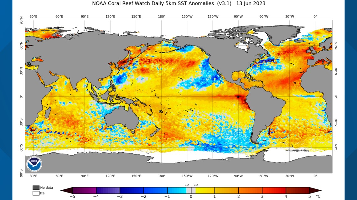
A climatic feature known as the Pacific Decadal Oscillation (PDO) is one of the reasons low pressure has been so persistent. However, warm waters have eroded the cold sea surface temperatures to the north, but from the Pacific Northwest south to the south of the tip of Baja and west towards Hawaii the cold water remains. When cold waters dominate this region of the Eastern Pacific, it is known as the negative phase of the Pacific Meridional Mode (PMM). Systems continue to spin up over the unusually cool waters, ushering in cooler temperatures, cloud cover and precipitation (mainly to the Sierra).

It's difficult to pin down the unusual West Coast weather to one factor. The developing, potentially strong, El Nino could be playing a role, along with the subtropical branch of the jet stream being pointed at California. The only thing sure in the near term is that low pressure seems determined to stick around through early to late June.
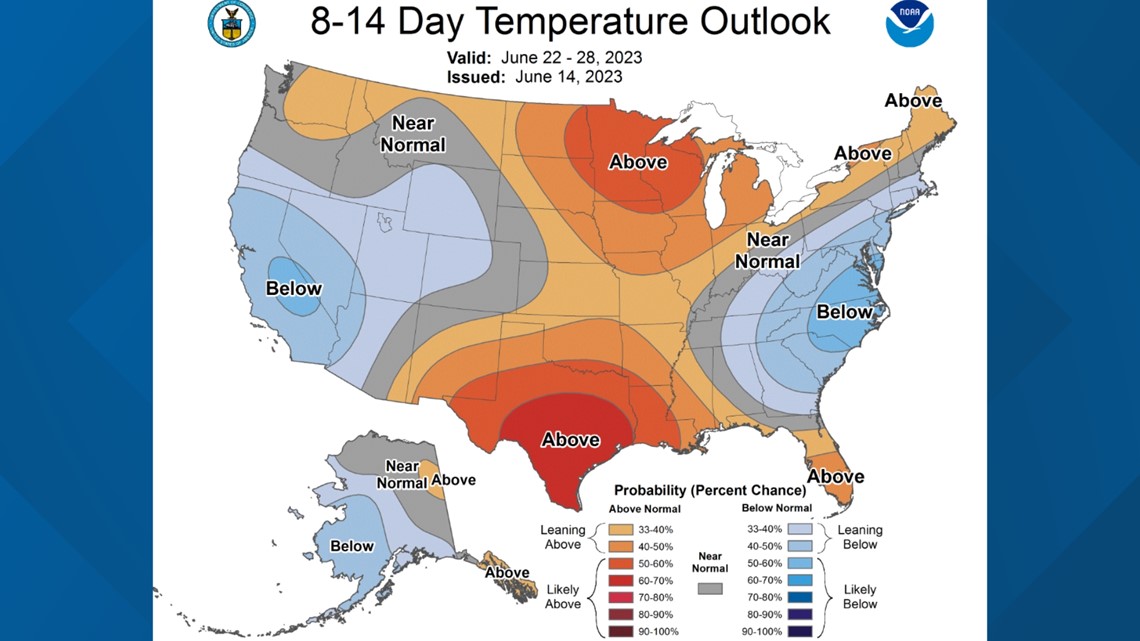
The Climate Prediction Center’s latest forecast has low pressure continuing to be the primary feature the next two weeks, apart from the short lived high pressure building in this week.

WATCH ALSO: