SACRAMENTO, Calif. — The upcoming weekend will be just about average for mid-June, but a major change in the weather will make its presence known by Sunday afternoon.
In the meantime, the warming trend continues for Northern California as high pressure noses its way into the region. Thursday is expected to be the first day with an above-average high temperature in Sacramento since June 4, and the city has still failed to reach 100 degrees this year.
June 17 is the first day of the year the average high temperature is 90 degrees in Sacramento, which is right about where temperatures will sit the next few days.
By the end of the weekend, a deep low pressure system and its associated cold front will drop into Northern California and temperatures will once again be below average.
Whether the plan is to hit the road or stay local, check out the localized forecasts below.
Central Valley
Friday and Saturday will be fairly warm across the Central Valley, especially with how cool it's been lately. Friday will be the warmest day of the week, as Sacramento is expected to reach 92.
Locations further north that don't have the influence of the Delta breeze will be a bit hotter and a few spots may even reach 100.
Saturday will be slightly cooler as the low pressure system inches closer, but Sacramento will still be near 90 degrees.
Expect limited cloud cover this weekend, even as the system moves in on Sunday, but winds will become gusty by Sunday afternoon. Gusts of 25 mph are expected in Sacramento. Low to mid 80s are expected in the valley Sunday and highs are expected to drop further by Monday.
The authorities still recommend staying away from rivers.
"Area waterways continue to run fast and cold due to snowmelt, creating dangerous conditions for even experienced swimmers," said NWS Sacramento. "Use extreme caution near waterways!"
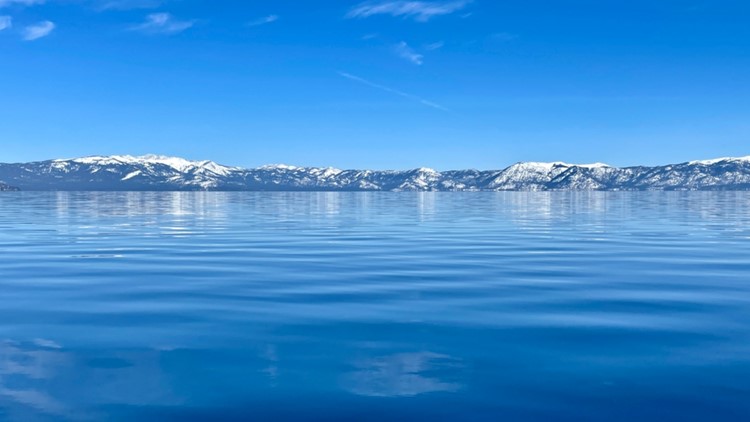
Tahoe/Sierra
The daily pop-up thunderstorms will cease this weekend due to the high pressure promoting stable air. June has been wet in the Sierra and most locations are exceeding 300% of average in terms of rainfall. Moisture has also been elevated this past week but humidity values will drop by this weekend and mostly sunny conditions will persist.
Temperatures will be pleasant in the Sierra this weekend, warming into the lower 70s Friday and Saturday. Sunday will be cooler and breezier due to the influence of the low pressure and temperatures will drop into the 60s. Gusts upwards of 40 mph are expected across the Sierra by Sunday afternoon.
Bay Area/Coast
Seasonal temperatures are expected this weekend along the coast and in the Bay Area. High temperatures Friday and Saturday in San Francisco will be in the upper 60s.
The persistent weather pattern has made "May Gray" and "June Gloom" even more noticeable this spring. Cumulative downward solar flux, a measure of how much solar radiation makes it to the ground vs. how much is reflected by cloud cover, is presented on the map below. Purple correlates to cloudier than normal conditions and it's easy to see how uncommonly cloudy it has been in the past month, especially along the coast.


The marine layer will once again be present this weekend but should burn off by the afternoon, leaving partly cloudy skies.
Temperatures will drop Sunday into the low 60s along with gusty winds as the cold front passes through.
WATCH MORE: Where are the 100s? California’s unusual season, peak snowmelt and nearly full water storage