SOUTH LAKE TAHOE, Calif. — Click here for Thursday fire coverage.
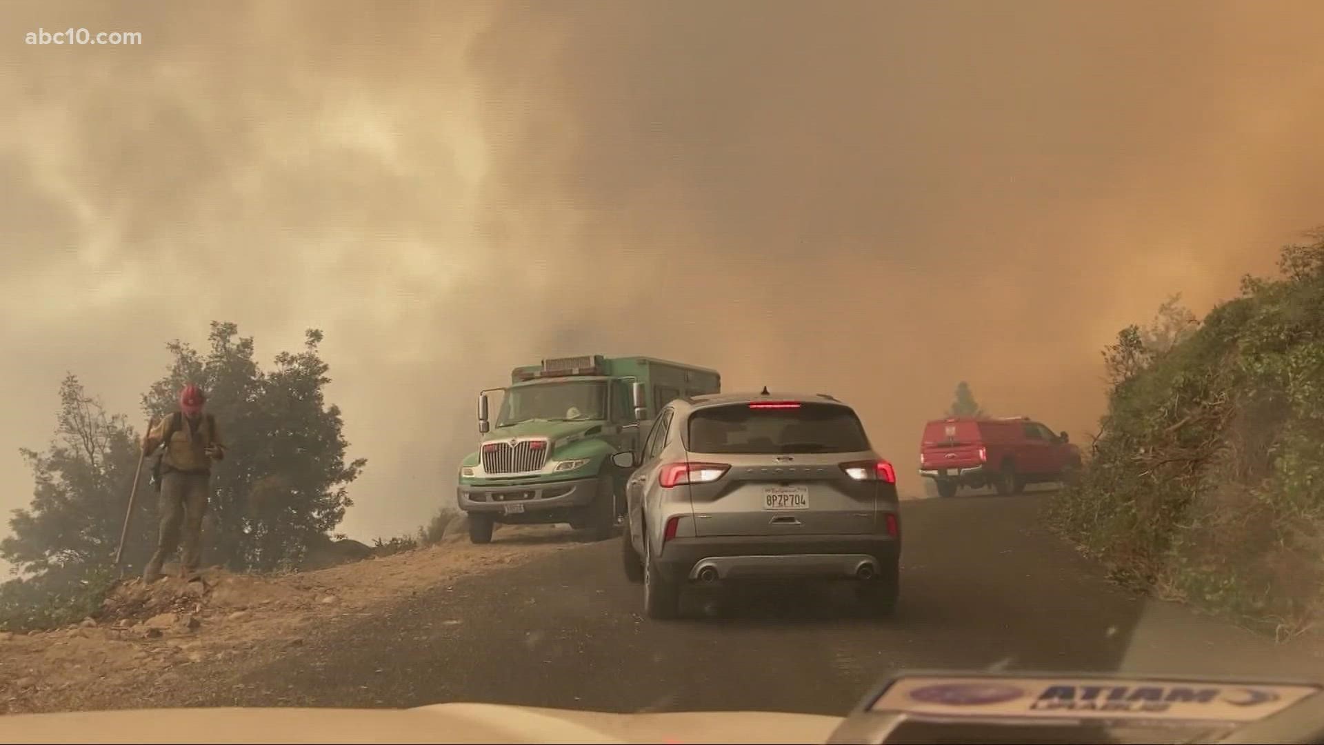
Thousands of firefighters are trying to box in a California wildfire that's advancing toward Lake Tahoe and has shrouded the popular vacation spot with a pall of ash and yellow smoke.
The Caldor Fire is less than 20 miles east of the lake that straddles the California-Nevada state line. People who hoped to boat, swim or gamble are finding themselves looking at thick haze instead of scenery. The Caldor Fire has destroyed at least 461 homes since it began Aug. 14 in the Sierra Nevada. It's still threatening more than 17,000 structures. Fire officials say it's the nation's top priority for fire resources.
The fire has grown to 126,566 acres and is 12% contained. The cause of the fire is still unknown. Highway 50 from Sly Park to Meyers remains closed to traffic. Two people have been injured and roughly 25,000 people are still under evacuation in El Dorado County.
Diane Nelson and her husband Rick say the Caldor Fire threatens their home on Fallen Leaf Lake near South Lake Tahoe. The couple were planning to host their daughter's wedding at the home on the picturesque lake, but cancelled it due to the smoke. They have spent the last two days coordinating with their wedding planner to move the wedding to the Bay Area.
Resorts have also been impacted by the smoke and wildfires. The Heavenly Village Gondolas were recently shut down do to the risk of wildfires.
In a evening update, fire officials said there'll be some reprieve from the winds in the coming days as the winds decrease to very light winds that won't be trying to push the fire over to the east as much. It's a pattern expected to hold throughout the week.
Operations Section Chief Eric Schwab said 2,100 acres have burned on the northside of Highway 50 so far as crews deal with spot fires.
With more than 24,000 people evacuated due to the fire, more than a dozen families have made a temporary home at the Amador County Fairgrounds. But the Amador County Sheriff’s Office is asking these evacuees to find a more suitable place to stay by tomorrow.
Amador County Sheriff Gary Redman tells ABC10 that, when the Caldor Fire broke out just over a week ago, the fairgrounds CEO opened the site up immediately to help evacuees with their animals and even allowed people to stay as well.
But the site doesn’t have water or sewer, and it isn’t meant to house people. The fairgrounds is currently footing the bill while evacuees stay there. The sheriff said there are shelters with resources available in the area, and any people who stay at the fairgrounds are a draw on limited resources to help survivors.
That’s why he’s asking everyone staying there to move to a more suitable location, either a shelter or another safe location with access to resources.
It’s important to emphasize that the sheriff said he does not have plans to force people away, but rather, he is strongly encouraging people to go. People can still leave their animals at the fairgrounds, where they’ll have 24 hour care.
Evacuations and Road Closures
Click HERE for in-depth evacuation orders and warnings in El Dorado County. For evacuation orders and warnings in Amador County, click HERE for the Amador County Sheriff's Facebook page and HERE for their website. For current state highway/route information visit roads.dot.ca.gov.
Evacuation centers
- Green Valley Community Church3500 Missouri Flat Road, Placerville, CA
- Evelynn Bishop Hall 701 Hwy 124, Ione, CA
- Rolling Hills Church 800 White Rock Road, El Dorado Hills, CA
- Douglas County Community Center 1329 Waterloo Lane, Gardnerville, NV
Shelter Full -- Cameron Park CSD 2502 Country Club Drive, Cameron Park, CA
Temporary Evacuation Point -- Amador County Fairgrounds 18621 Sherwood Street, Plymouth, CA
Animal Evacuation Centers:
- El Dorado County Animal Services: Call (530)-621-5795 (Small animals)
- Large Animal Shelter Amador County Fairgrounds 18621 Sherwood St., Plymouth (530)621-5795 or (530)647-6227
- Saureel Vineyards (large animals) 1140 Cold Springs Road Placerville, CA (530) 621-5795
Accounts to follow
Evacuation Maps
A map of evacuations from the El Dorado County Sheriff's Office is available below.
Wildfire map
Click here for a map of the Caldor Fire.
Structure Damage Map
A map of structural damage from the El Dorado County Sheriff's Office is available below.
►Stay in the know! Sign up now for the Daily Blend Newsletter
What questions do you have about the latest wildfires? If you're impacted by the wildfires, what would you like to know? Text the ABC10 team at (916) 321-3310.
Wildfire Preps
If you live in a wildfire-prone zone, Cal Fire suggests creating a defensible space around your home. Defensible space is an area around a building in which vegetation and other debris are completely cleared. At least 100 feet is recommended.
The Department of Homeland Security suggests assembling an emergency kit that has important documents, N95 respirator masks, supplies to grab with you if you’re forced to leave at a moment’s notice. The agency also suggests signing up for local warning system notifications and know your community’s evacuation plans best to prepare yourself and your family in cases of wildfires.
Some counties use Nixle alerts to update residents on severe weather, wildfires, and other news. To sign up, visit www.nixle.com or text your zip code to 888777 to start receiving alerts.
PG&E customers can also subscribe to alerts via text, email, or phone call. If you're a PG&E customer, visit the Profile & Alerts section of your account to register.
Watch more from ABC10
PG&E worker plans to testify about start of Dixie Fire

