
FORESTHILL, Calif. — Monday's updates are at /article/news/local/wildfire/mosquito-fire-map-update-evacuation/103-e0c84225-a983-498f-a167-62914c5b24cf
---------
Sunday's article:
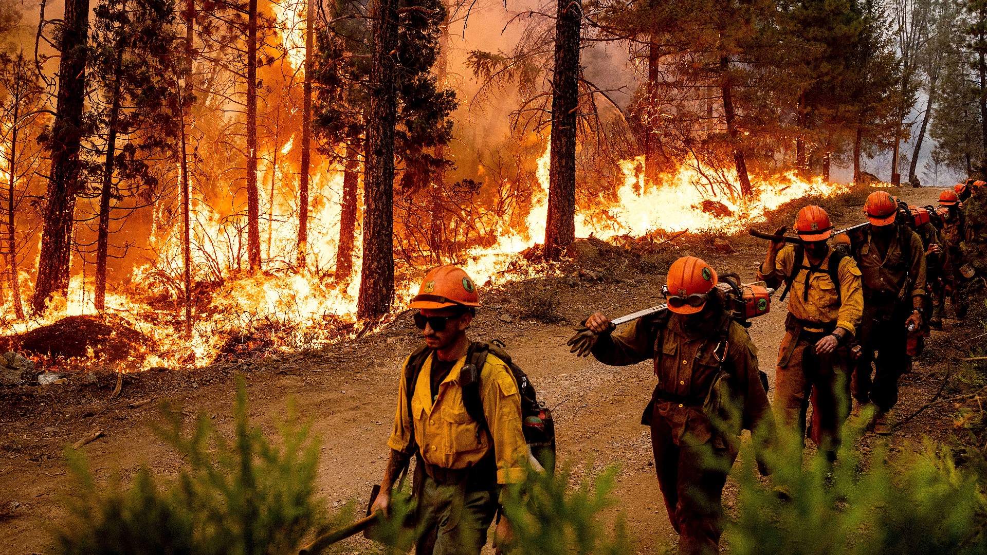
Authorities said crews faced an increase in fire activity Sunday after a smoke inversion lifted over much of the Mosquito Fire.
The wildfire burning in both Placer and El Dorado counties has scorched 46,837 acres and is just 10% contained so far. More than 11,000 people have been forced to leave their homes as 5,848 structures remain under threat.
In an Sunday evening update, Cal Fire and the United States Forest Service said there was no westerly progress on the fire. Cal Fire NEU Unit Chief Brian Estes said forward progress of the fire in Placer County has been stopped to the west and fire has been put in place around Foresthill.
"We have direct fire line established from Baltimore Mine to the American River. The forward progress of the fire in Placer County has been stopped to the west, and we are securing that and we will maintain that securing of that fire," Estes said.
Landon Hack, Operations Section Chief, the Mosquito made a run toward Westville between Foresthill Road and Deadwood Road. He said the fire has been moving toward the east, but noted there was no southeast progress in the last 12 to 24 hours. With containment on the south end of the fire, there's been no more progress toward Quintette.
► Scroll down for evacuation maps and other fire resources.
PHOTOS: Scenes from the Mosquito Fire
The Mosquito Fire’s cause remained under investigation. Pacific Gas & Electric said unspecified “electrical activity” occurred close in time to the report of the fire on Tuesday.
Stay Informed
Live Evacuation Maps
Placer County Sheriff's Office evacuation map (You need to click the "I Understand" box to use the map):
El Dorado County Sheriff's Office evacuation map (You need to click the "I Understand" box to use the map):
STAY INFORMED WITH ABC10:
► ABC10 In Your Inbox: Sign up now for our daily newsletter for local headlines, weather, tips and even something to make you smile.
► ABC10 On Demand: Get access to our local news, live programming and weather with the free ABC10 app for Roku and Amazon Fire TV.
Evacuation Centers
Evacuation centers:
- Rocklin: Sierra College at 5100 Sierra College Blvd
- Cameron Park: Cameron Park Services District at 2502 Country Club Drive
- Overnight shelter, meals, showers, limited health services, and parking for trailers will be provided. Animals in crates and carriers will be accepted.
- Placerville: Green Valley Community Church at 3500 Missouri Flat Rd.
- No Large animals or no birds. Limited RV parking and no hookups
For large and small animals:
- Nevada County Fairgrounds on 11228 McCourtney Road, in Grass Valley Check-in at Gate 8
- Placer County Animal Services Center at 11232 B Avenue in Auburn
- No birds/chickens due to avian flu
- El Dorado County Animal Shelter 6435 Capitol Avenue, Diamond Springs
- Rancho Murieta Equestrian Center, 7200 Lone Pine Dr, Rancho Murieta
- Must call first: (916) 985-7334
- Large animals only: Flying M Ranch, 82 Carefree Way, Oroville
Fire Map
This map from the National Interagency Fire Center shows fire activity (this may take a few seconds to load):
Road Closures
For a Waze map with current road closures, click here.
WATCH MORE: How fire crews were able to protect Foresthill:


