
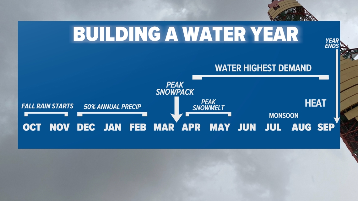
SACRAMENTO, Calif. — The water year in California runs from Oct. 1 through the following September 30. The timeline helps water managers prepare for the onset of the wet season, in October, and for the dry season, June through September.
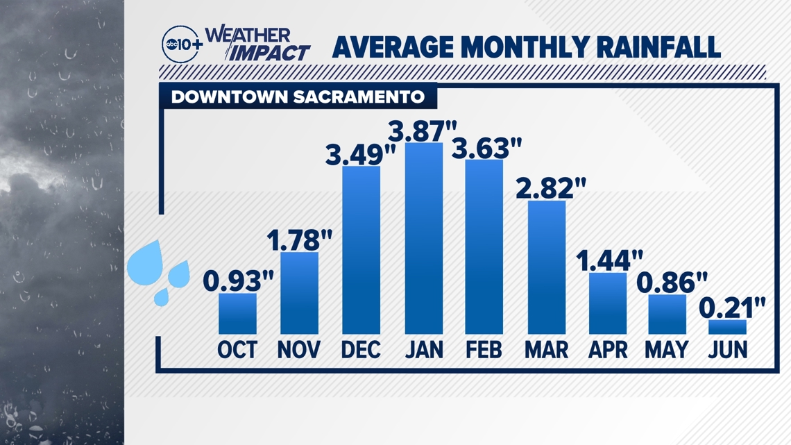
A typical water year begins with the onset of precipitation in October with nearly half of the annual total falling December through February. Rain and snow totals begin to lower in March before dropping off in May. At that point, water demand is at the highest point and temperatures warm, resulting in more evaporation. This helps illustrate the critical need for winter precipitation.

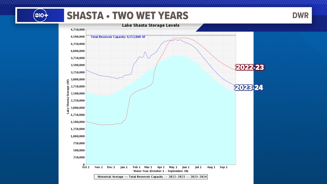
California entered the 2023-24 water year with a big cushion in water storage. The previous year broke the ongoing drought and delivered not only beneficial rain but record setting snow. This helped replenish groundwater supplies and filled many reservoirs.
Here is a snapshot of Shasta's storage in back to back wet years. Water levels were nearly at capacity during the snowmelt period and then as water demand rose, water levels fell. This also helps water managers make room for the upcoming precipitation events and snowmelt.

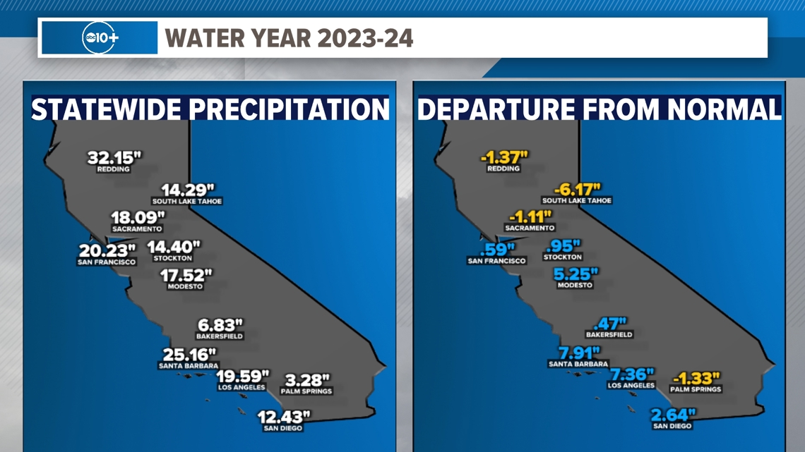
The 2023-24 water year also featured one of the strongest El Niño events on record. The threshold for El Niño is when the Oceanic Niño Index reaches +0.5° C in tropical Pacific water. This El Niño Southern Oscillation (ENSO) tends to favor a wetter than average Southern California with an equal chance of above to near normal precipitation for Northern California.
The numbers generally support this pattern throughout the state. The big gains in the southern part of the state helped take pressure off the largest reservoirs in the northern part of the state during the dry months.

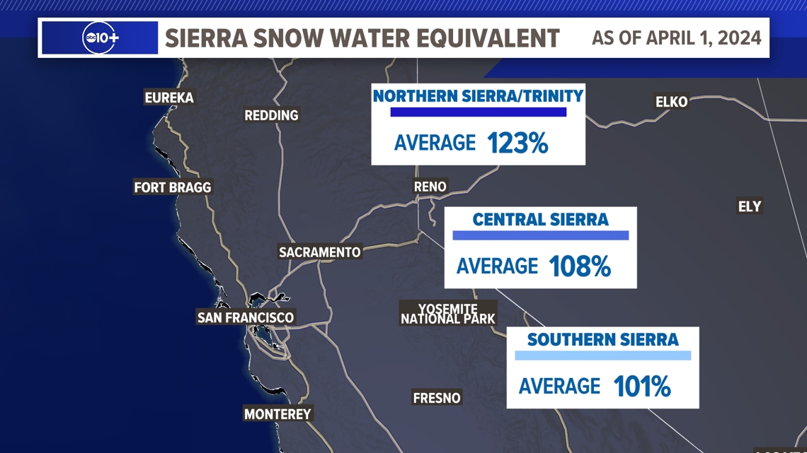
One of the most important key indicators of water supply health in the state is Sierra snowpack. This frozen savings account of water is responsible for 30% of the supply in the state. The snow melts slowly into reservoirs, which is then sent to drier areas through the year. Although the winter featured less snow than the previous year, by April 1 the statewide snowpack was above average. This date is used because this is the time the snowmelt tends to outpace the snowfall.

Statistically, rainfall for Downtown Sacramento picks up in November with most of the precipitation falling from December through February. March still favors a wet pattern before much drier conditions arrive April through May. The window is small for capturing water in the state.

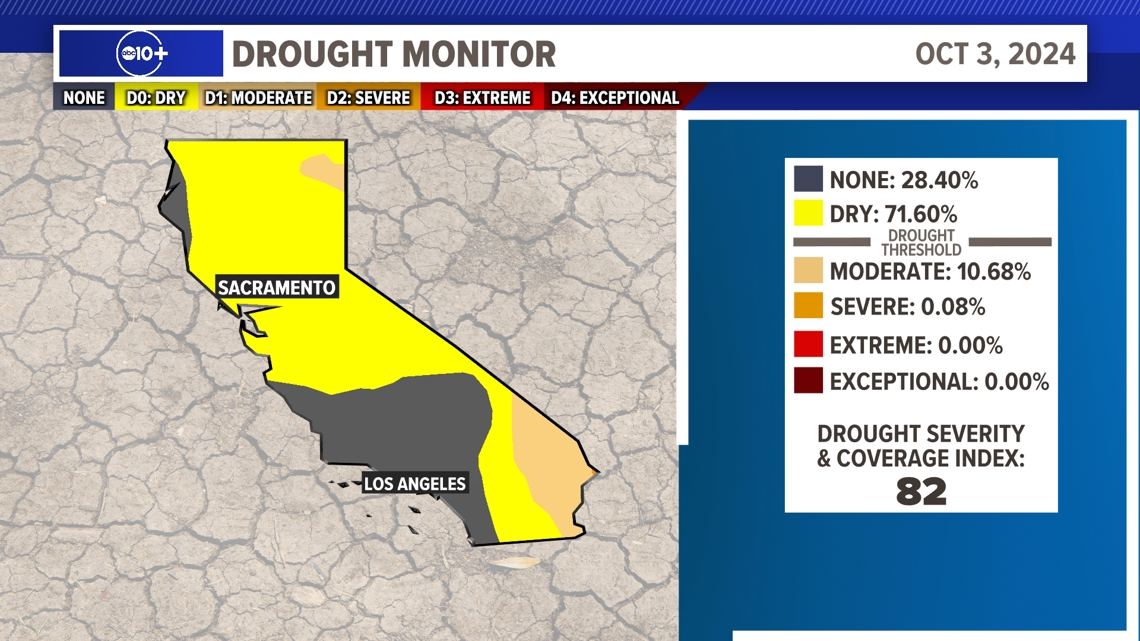
The U.S. Drought Monitor is holding steady right now with only about 10% of the state seeing Moderate Drought and less than 1% seeing Severe Drought. The next months are critical to keep the state from digging deeper into dryness.

The last decade has been challenging with weather extremes creating more variability. The swings from wet to dry are becoming more pronounced.
The weather patterns aren't following a typical cycle. Droughts are getting hotter leading to more evaporation. Flooding is becoming a greater risk as the atmosphere warms and holds more moisture. This is why there is much anticipation at the beginning of each water year. Anything is possible. For more on what to expect this upcoming water year, click HERE..
WATCH ALSO:
California's Water & Weather: Reservoir levels, storage and how numbers ranked


