
SACRAMENTO, Calif —
A robust system of low pressure off the coast of California and an associated atmospheric river has already started to bring impacts to Northern California.
This storm already delivered healthy rain totals across Northern California and even a few thunderstorms in the early morning hours that woke up many across the region. As of noon, Sacramento Executive Airport is reporting 0.72" of rain and the valley is expected to add another 1-2" by Wednesday night.
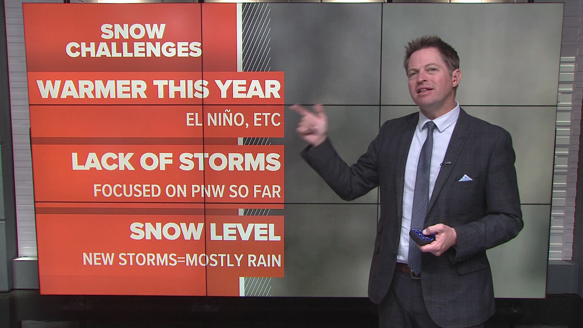
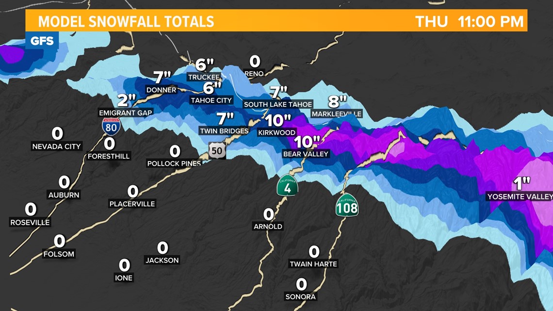
This is still a majority rain event due to snow levels being around 8,000 feet but light snow is still expected above pass level with the heaviest falling south of Highway 50.

Monday afternoon/night
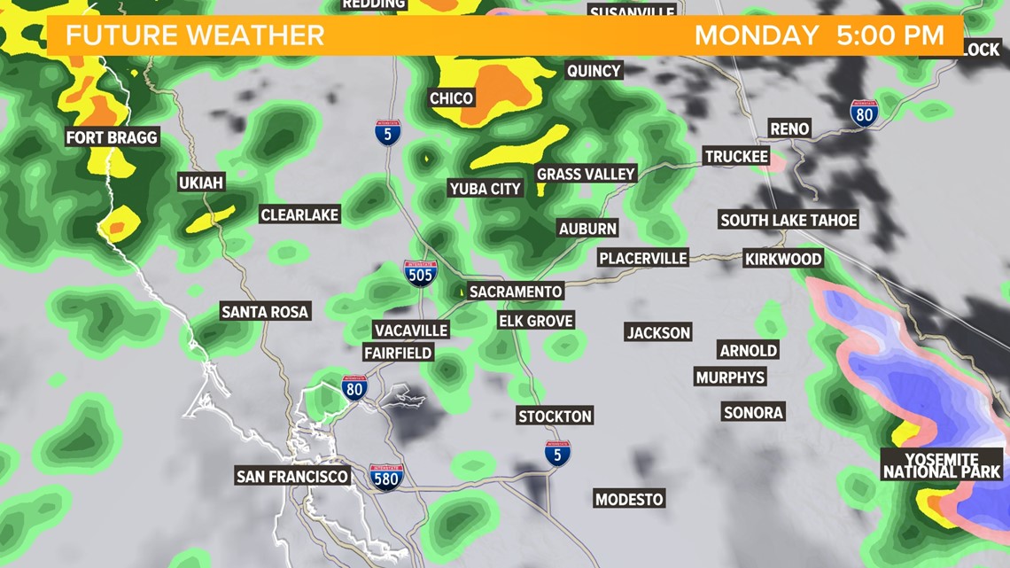
Expect shower activity to resume after a lull in activity following the wet morning commute. Rain showers during this period will be showery in nature and difficult to predict exactly where they will pop up.
Futurecast shows rain pushing into the region during the evening commute and snow falling mainly south of Highway 50 above 7,500 feet.
Gusty conditions are expected during this period, continuing into Tuesday. Gusts of 30-35 mph are expected with the highest gusts in the Sierra.

Tuesday morning
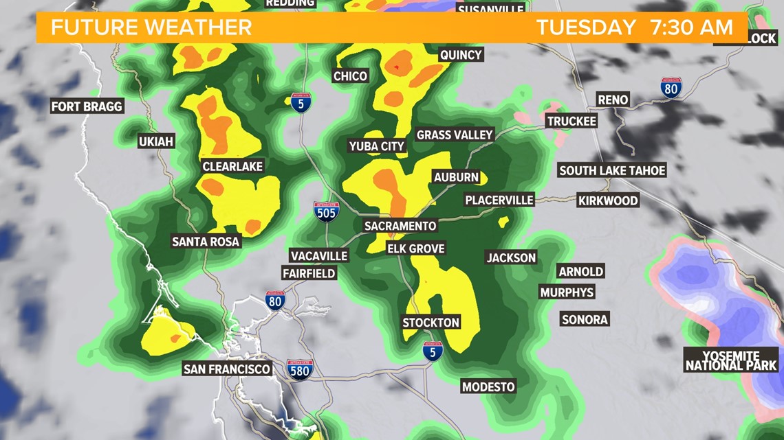
Another soggy commute is expected on Tuesday morning.
Periods of moderate to heavy rain are expected throughout the morning hours and snow levels will remain high.

Tuesday night
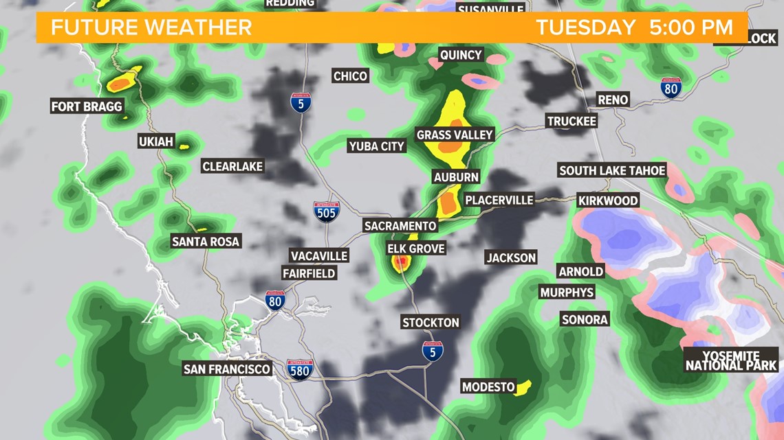
Futurecast is indicating the potential of thunderstorm development Tuesday afternoon.
Showers will continue Tuesday night and snow levels will have dropped to the 6,500-7,000 foot range thanks to secondary center of low pressure that will sneak in behind the first, reinforcing the system will some colder air.

Wednesday
Rain and snow will be possible across Northern California throughout most of the day Wednesday, but by the evening the majority of the precipitation will be spreading south as the low follows the coast towards Southern California.
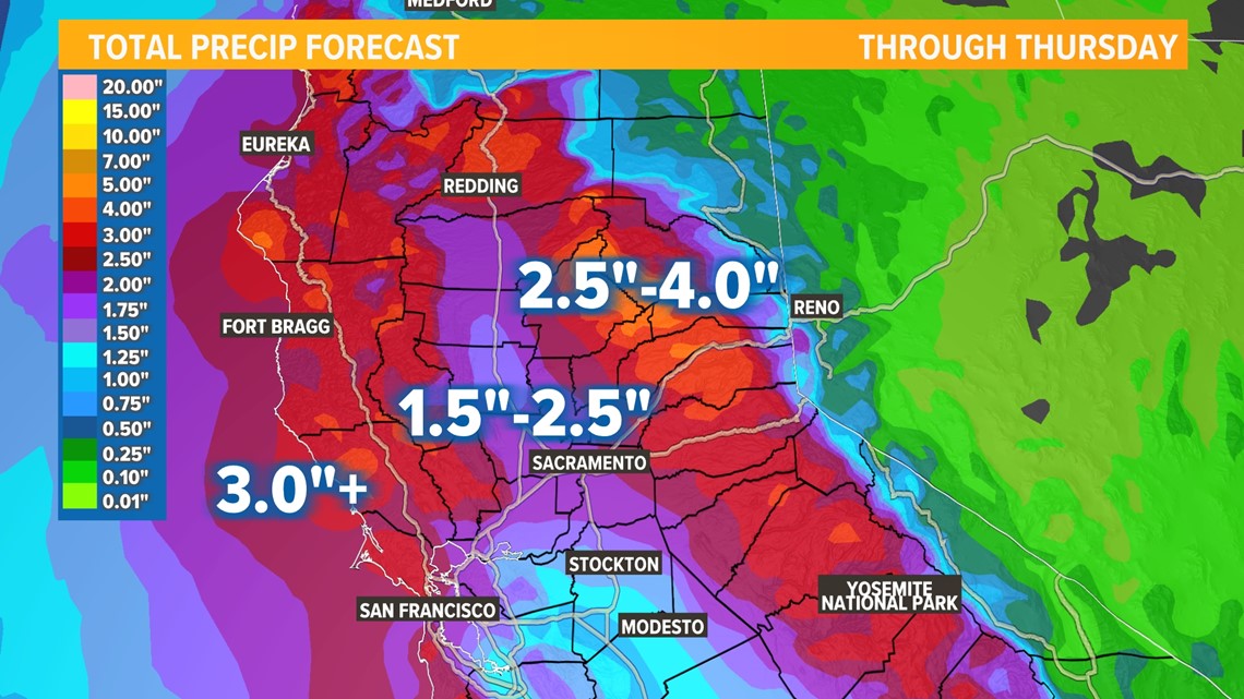
Rain totals ranging from 1.5-2.5" in the valley and upwards of 4" in the foothills are expected through Thursday.

After Wednesday, a dry stretch is expected through Christmas. However, a strong Pacific jet stream is expected to deliver more storms to the region in the week sandwiched between Christmas and New Year's Day. The Climate Prediction Center favors warmer and wetter conditions through the end of the year.