

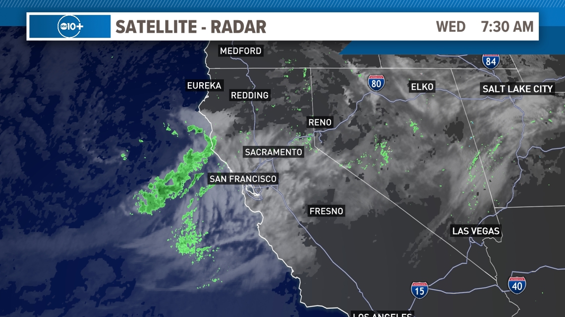
SACRAMENTO, Calif. — There are lots of weather changes left this week as one more system brings a variety of changes across the northern part of California. The theme is for lower temperatures that are quite a bit below normal and periods of light rain and showers. Then we will see warming for the rest of the week.

WEATHER RESOURCES:
► FORECAST DETAILS | Check out our hourly forecast and radar pages
► GET WEATHER ALERTS TO YOUR PHONE | Download the free ABC10 mobile app
► GO DEEPER | Stream in-depth weather forecasts with the free ABC10+ streaming app
► WEATHER IN YOUR EMAIL | Sign up for our daily newsletter
► MEET THE WEATHER TEAM | Chief Meteorologist Monica Woods, Carley Gomez, Brenden Mincheff, Rob Carlmark
WEDNESDAY
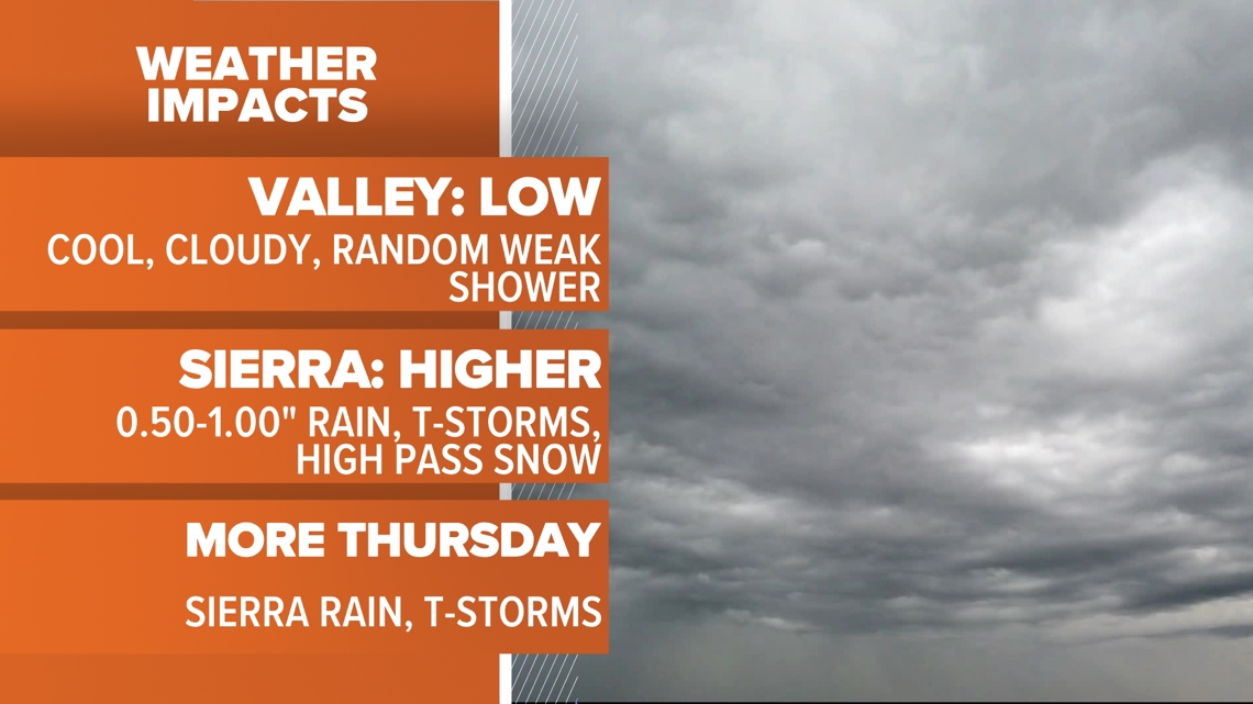
As the second system arrives midweek, afternoon temperatures again cool down into the 70s. Wednesday also has a better, more widespread chance for showers.

Rain will start in the Sierra with widespread showers and snow to about 8,000 feet. This system will not be as cold and will result in mostly rain for the Sierra. We should get at least 0.25-0.50" of rain up high.
For valley locations clouds will move in early and a random shower is possible during the day. The most likely time for steady light rain is in the evening past sunset but this could change. Rain totals should be very light and less than 0.10". Many places will only see clouds.

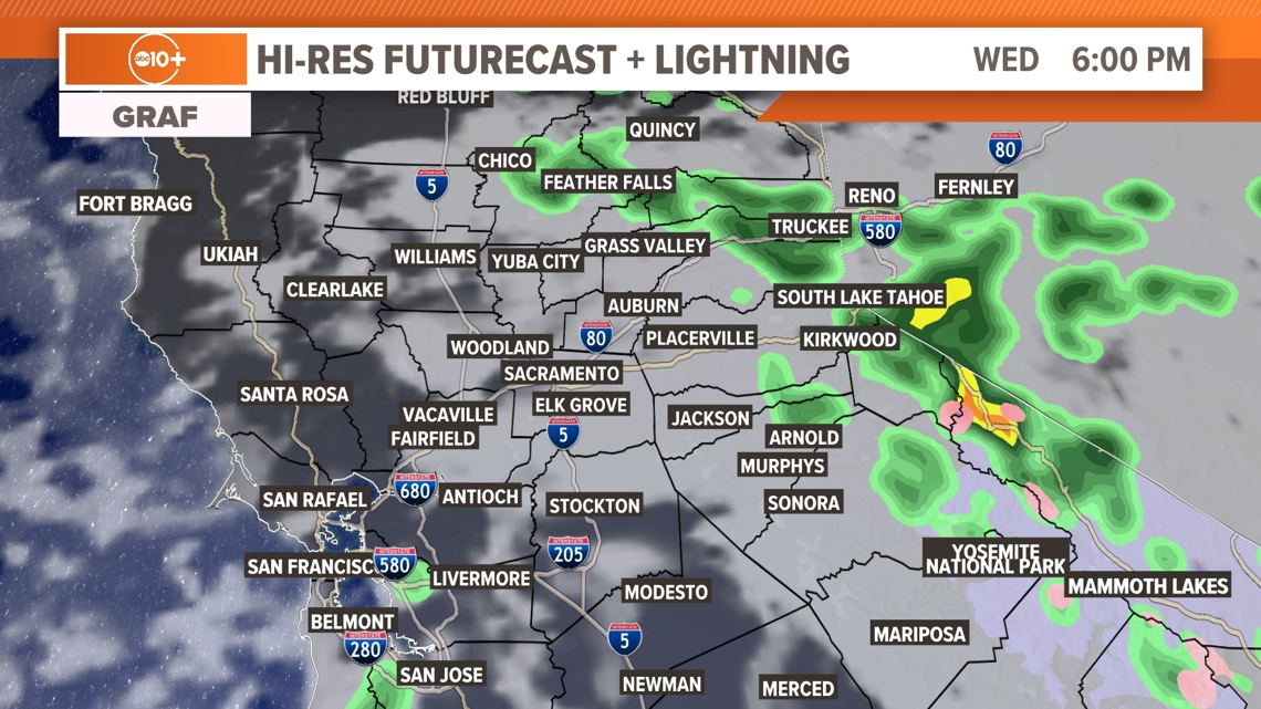
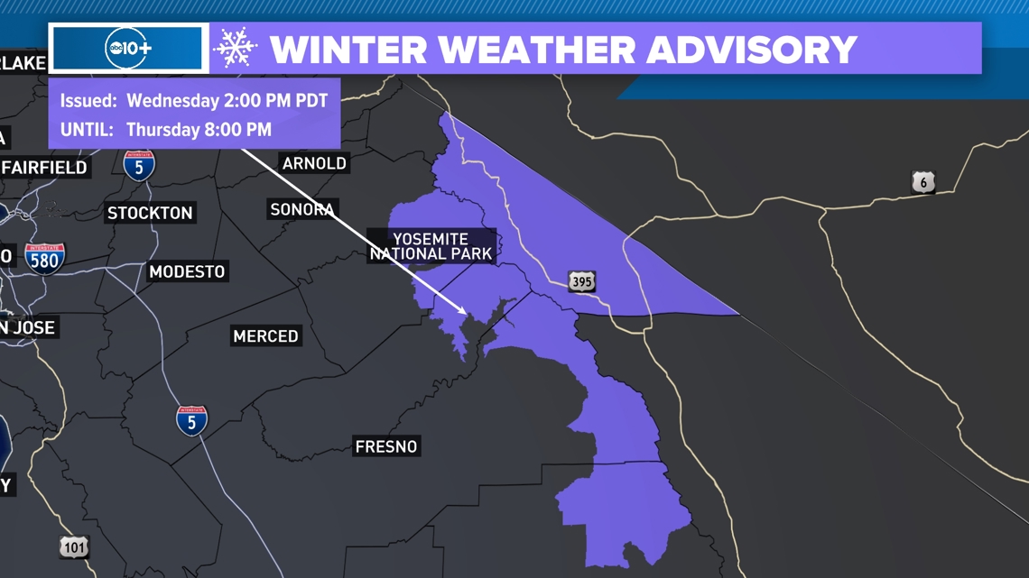
The Sierra will see some snow down to about 8,000 feet. This is prompting a very early Winter Weather Advisory for the central Sierra for high elevations.

THURSDAY
The second storm system will be exiting the region on Thursday, bringing an end to the cooler and unsettled weather pattern for the valley. However, instability remains in the Sierra where an extra day of showers and thunderstorms is possible along with high elevation snow.

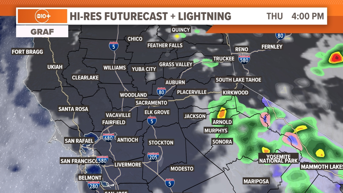
A brief period of some north winds down the valley is possible Thursday morning through the early afternoon as the system leaves the area.
Temperatures will undergo a slow warming trend beginning with an afternoon in the low to mid-80s on Thursday. By the weekend, we're back in the 90s.
Sunday is the first official day of fall and temperatures will be near 92. Monday it's back to the mid-90s. Enjoy the changes in the weather this week.
FRIDAY
Temperatures continue to warm with sunny skies. We should see valley highs in the upper 80s which is average for this time of year. Sierra conditions will be sunny as well with Temperatures in the 60s. We will see warming well into the weekend with a return to the 90s by Sunday, the first day of fall. The 90s remain for most of next week.
WATCH MORE: What does La Nina mean for California?


