SACRAMENTO, Calif. —
Monday's updates are HERE.
Sunday's updates are below.
---------
Problems still remain Monday as the Sacramento region is drying out and cleaning up after Saturday brought flooding, evacuations, road closures, and power outages.
FLOODING
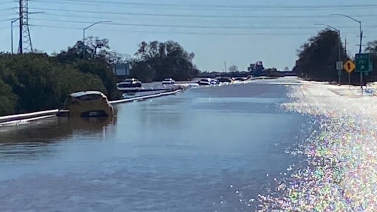
Highway 99 reopened south of Elk Grove in traffic in both directions shortly after midnight, Caltrans announced. It was closed Sunday due to flooding.
Officials have escalated the evacuation warning for the Point Pleasant area to an evacuation order due to imminent flooding in the area. Flood waters are expecting to become "incredibly dangerous" after sunset.
An evacuation warning was issued to people living in the areas of Glanville Tract and Franklin Pond, calling on people to prepare to leave the area before roadways are cut off to evacuate the area.
County spokesperson Matt Robinson said there are three levee breaches in the Cosumnes River area, which are believed to have been weakened when they were hit by debris during the 2017 floods. It's not clear what time the failures happened, but the breaches were confirmed by helicopter in the morning.
The Sacramento County Office of Emergency Services is expecting flooding from the Cosumnes River and the Mokelumne River to move southwest toward I-5, potentially reaching these areas in the middle of the night.
Highway 99 was closed Sunday morning between Galt and Grant Line Road after the river breached the levee, according to Caltrans. The Cosumnes Fire District told ABC10 Sunday morning that it has made dozens of rescues over the last 24 hours.
Flooding has also temporarily shut down all northbound lanes of Highway 99 at Acampo Road. Drivers are advised to watch for flooding along Highway 99, just north of Lodi.
The National Weather Service has Flood Warning in effect until 11:15 p.m. Sunday due to the rain and runoff. A Flash Flood Watch was also issued along and west of Interstate 5 to the Sacramento River, south to Walnut Grove, north to Elliot Ranch Road. Officials said excessive rain and floodwaters on the Cosumnes and Mokelumne Rivers might quickly inundate areas in the watch area.
Sacramento County proclaimed a winter storm state of emergency, Saturday evening. Meanwhile, due to recent weather in the area, the Directors of Emergency Services for San Joaquin County have declared a local state of emergency.
"We have not seen the widespread flooding impacts that Sacramento is currently seeing but we have numerous issues including major roadway closures, mudslides, and localized flooding," said Heyer. "We are currently working with partners to identify damages addressed overnight and monitoring the Mokelumne River at Benson’s Ferry and Mormon Slough at Bellotta."
Saturday night the El Dorado County Sheriff's Office downgraded its Evacuation Order in Cameron Park to an Evacuation Warning. By Sunday, it was lifted for the area between Cameron Park Lake and Piper Court, Cameron Park - Area between Salida Way and Bonanza Drive, Cameron Park - South of Sandridge Road and Highway 49 to the Amador County border
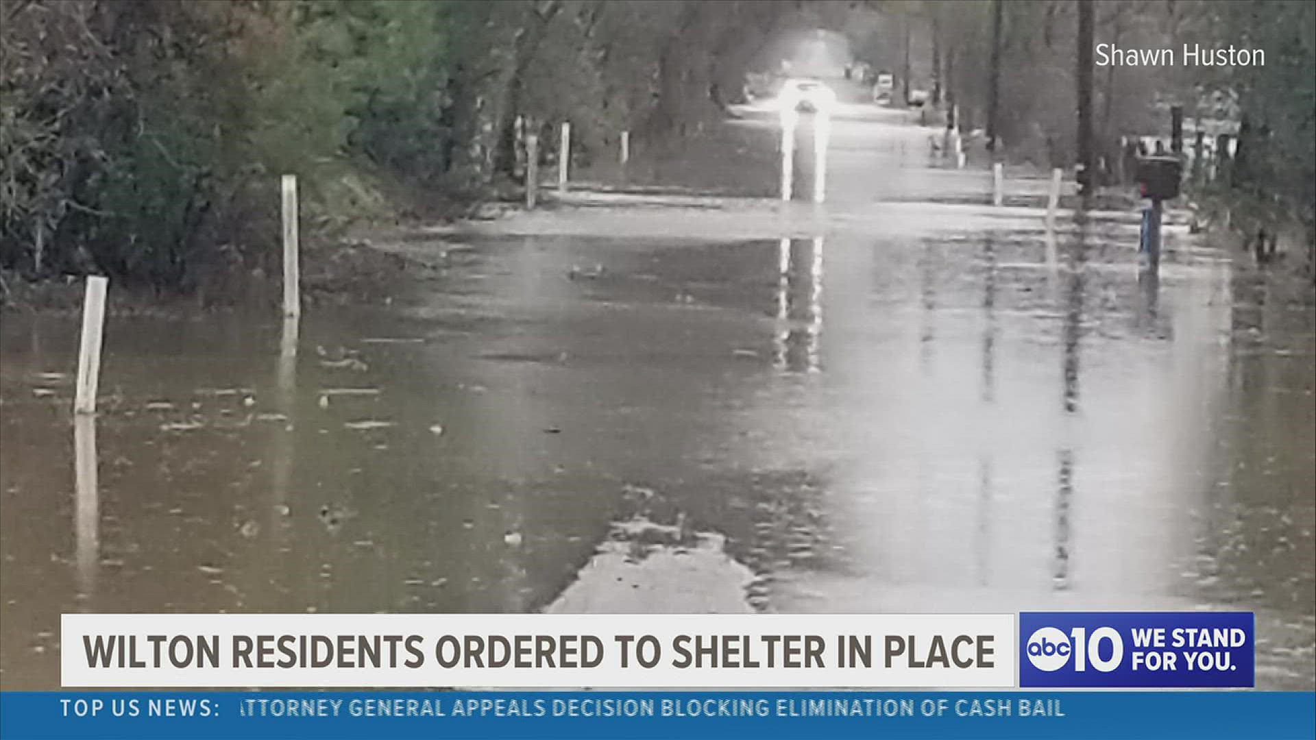
The National Weather Service continued a Flash Flood Warning for Wilton until 11 a.m. on Jan. 2. People were urged to move to higher ground and avoid walking or driving through flood waters. The potential exposure in the area is about 8,230 people.
POWER OUTAGES
As of 8:50 p.m., SMUD was dealing with more than outages affecting more than 14,000 of its customers. Earlier Sunday morning more than 54,000 customers were without electricity.
PG&E is reporting hundreds of outages from the Sierra to the Bay Area with one of its largest being more than 5,000 customers in Rio Vista being without power.
SIERRA ROAD CONDITIONS
The CHP and CalTrans warned drivers to stay off the roads overnight in the Sierra as Interstate 80 was closed due to the snow. Highway 50 and Interstate 80 reopened Sunday morning, with some chain controls needed:
- Interstate 80: Between Nyack and Nevada State Line
- Highway 50: Between Kybruz and Meyers
- Check other highways HERE.
► WATCH: Saturday's flooding in Wilton:
STORM RESOURCES
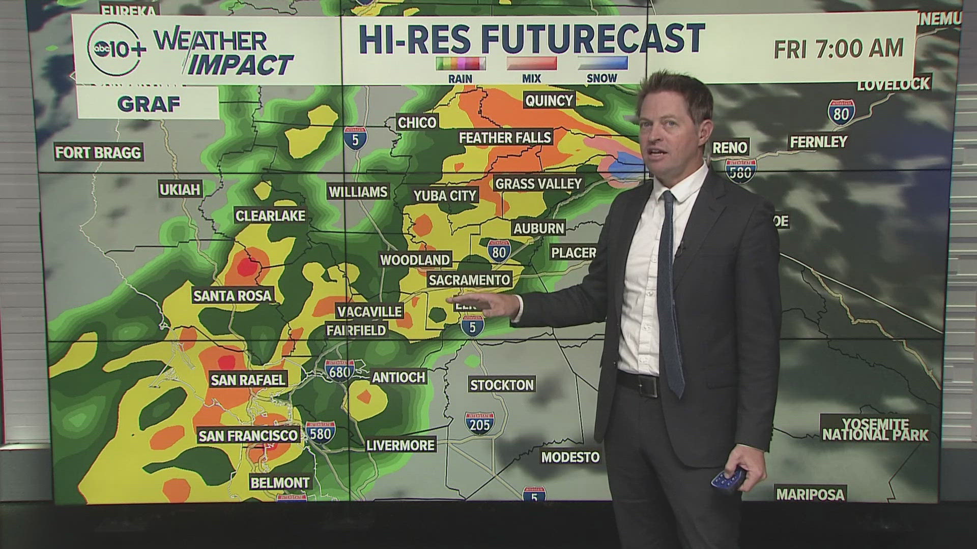
► FORECAST DETAILS | Check out our hourly forecast and radar pages.
► GET WEATHER ALERTS TO YOUR PHONE | Download the ABC10 mobile app
► WEATHER IN YOUR EMAIL | Sign up for the ABC10 Today newsletter
MAPS
Radar map from ABC10.com. Adjust the layers with a filter on the bottom right corner to show rain, snow, wind and current temperatures:
TRAFFIC
Sacramento region traffic:
Live map showing traffic conditions along Interstate 80, Highway 50, Highway 89 around Lake Tahoe and the Sierra Mountains. Snow Park locations are identified with purple markers:
POWER OUTAGES
PG&E outages can be found HERE.
SMUD outages can be found HERE.
Click HERE for more ABC10 weather maps.
GO DEEPER: When you think of California's climate, drought probably comes to mind first, but California has a long history of floods. Some floods were so punishing and relentless they crippled the state. New research indicates these "megafloods" are twice as likely in the future with a changing climate. It's a future we can't avoid, but we can learn from the past and prepare. ABC10's team of meteorologists investigated the topic, answering questions like: What exactly is a megaflood? Can our infrastructure withstand it?


