
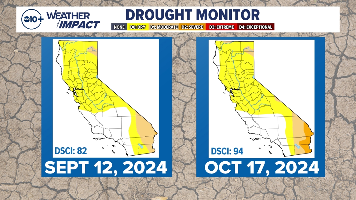
SACRAMENTO, Calif. — The new U.S. Drought Monitor shows growing severe drought in the southeast corner of California. Moderate drought is also expanding in the same region and the northern border near Oregon.
The Drought Severity and Coverage Index also jumped from 82 to 94 in the last month. This index is an experimental product from the U.S. Drought Monitor converting drought levels to a single value.
DSCI values are from 0 to 500, with zero representing an area with no abnormally dry or drought conditions. A value of 500 means all of the area is in the most critical category, exceptional drought.

The 2023-24 water year ended with much of the state seeing near-normal precipitation. Once the dry season hit in May, several events led to growing dryness.
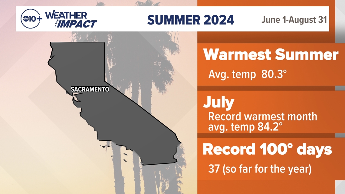
One of the biggest factors was record-setting heat blanketing much of the state during the meteorological summer which runs June 1 through August 1. Downtown Sacramento had its warmest summer ever with an average temperature of 80.3°. The city also had its warmest month on record in July with an average temperature of 84.2°.
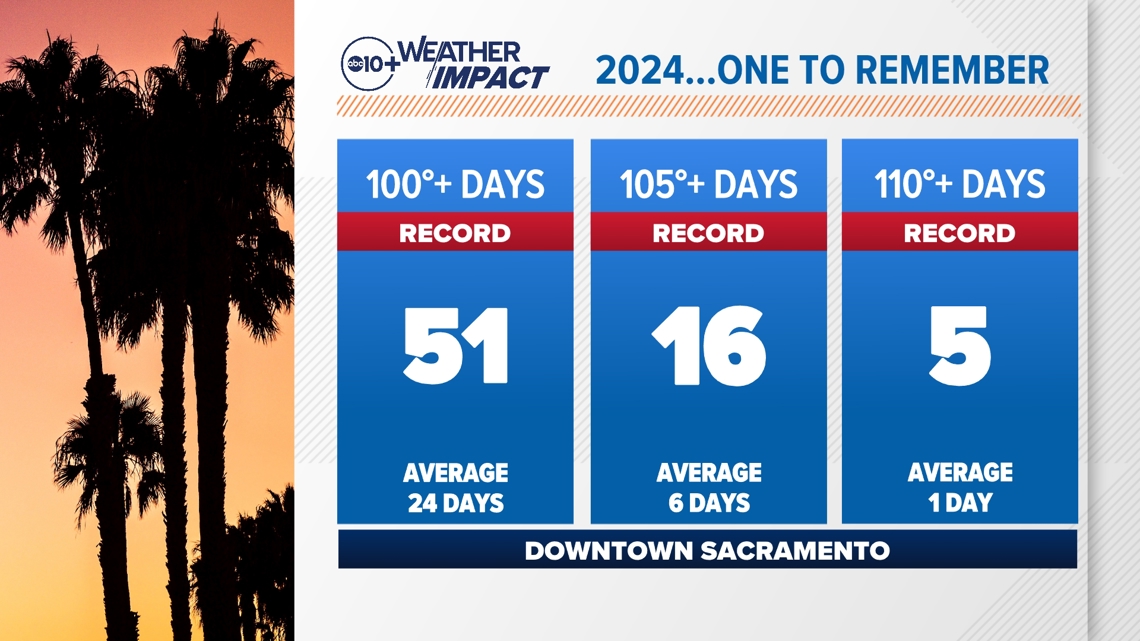
By the end of the season, downtown recorded 37 days in the 100s. That number continued to grow.

September added eight days and October added six, a record for the month. This brought the calendar year total to 51 days, breaking the old record of 44 days set in 2022.
Alongside these records were the number of days at 105° at 16 and number of days at 110° at five. 2024 has been a year to remember and one for the record books.

The bottom line with the heat is how it increased the rate of evaporation and contributed to growing drought conditions and fuel dryness. Critically low moisture led to increasing fire danger along with elevated risk for significant wildland fire.
Reservoirs have been somewhat insulated from the recent dryness given the last two wet water years. They remain at or above historical averages, which gives water managers a cushion heading into the 2025 Water Year.
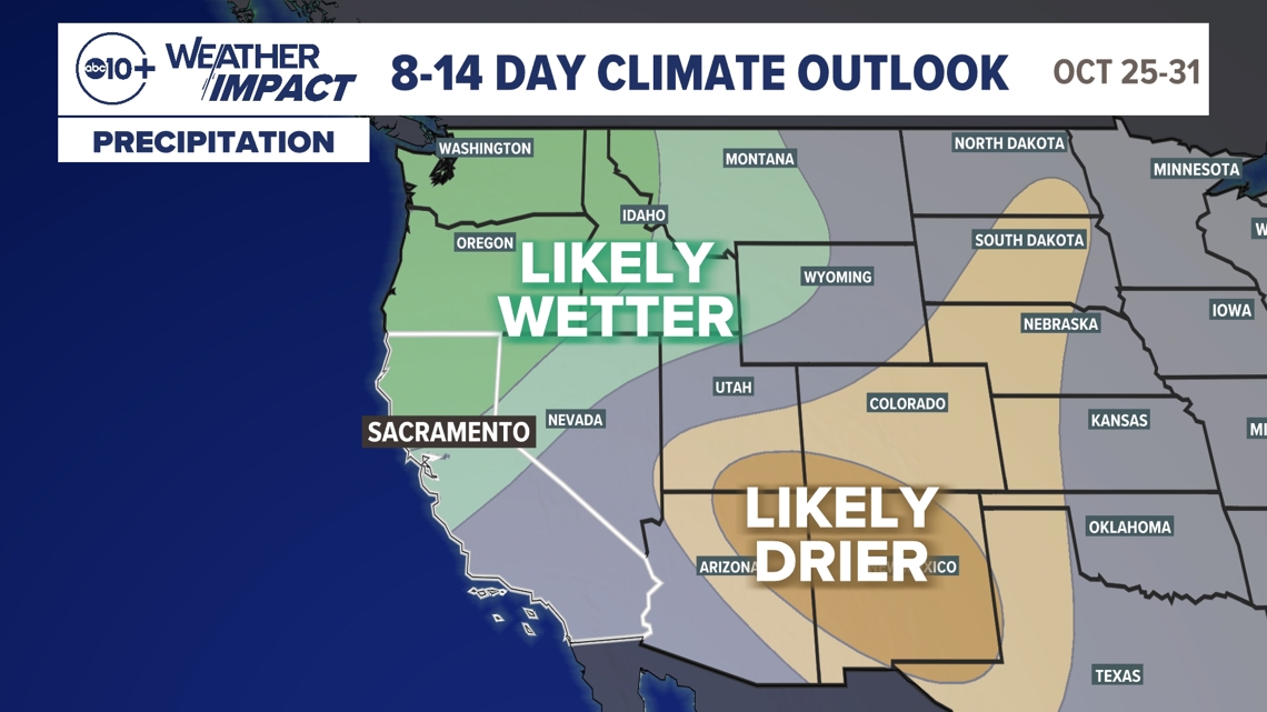
The start of this current water is off to a slow start and is building on the preexisting conditions. Looking ahead, there is an indication of a wetter than average pattern developing toward the end of October. Areas along the California-Oregon border would most benefit from this forecast and could help to minimize some of the growing moderate drought and abnormally dry conditions.

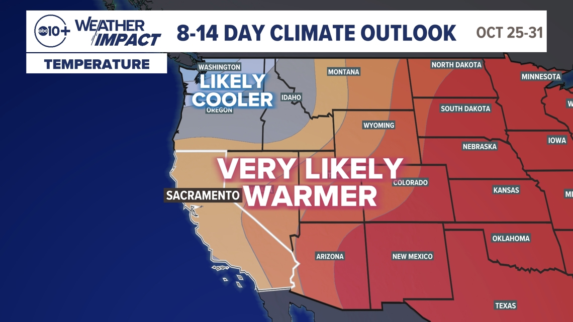
The 8-14 day outlook though also shows a likelihood of a warmer than average pattern. This could result in precipitation likely falling as rain, not snow in the mountains, which would end up as runoff, potentially stored in reservoirs not the desired snowpack.

The wet season is still young though with 50% of precipitation typically falling in December, January and February. A La Niña pattern is still forecasted for the winter months, which typically favors a wetter than average Pacific Northwest and a drier than average Southern California. This is the cooling of tropical Pacific waters that can have global weather impacts.